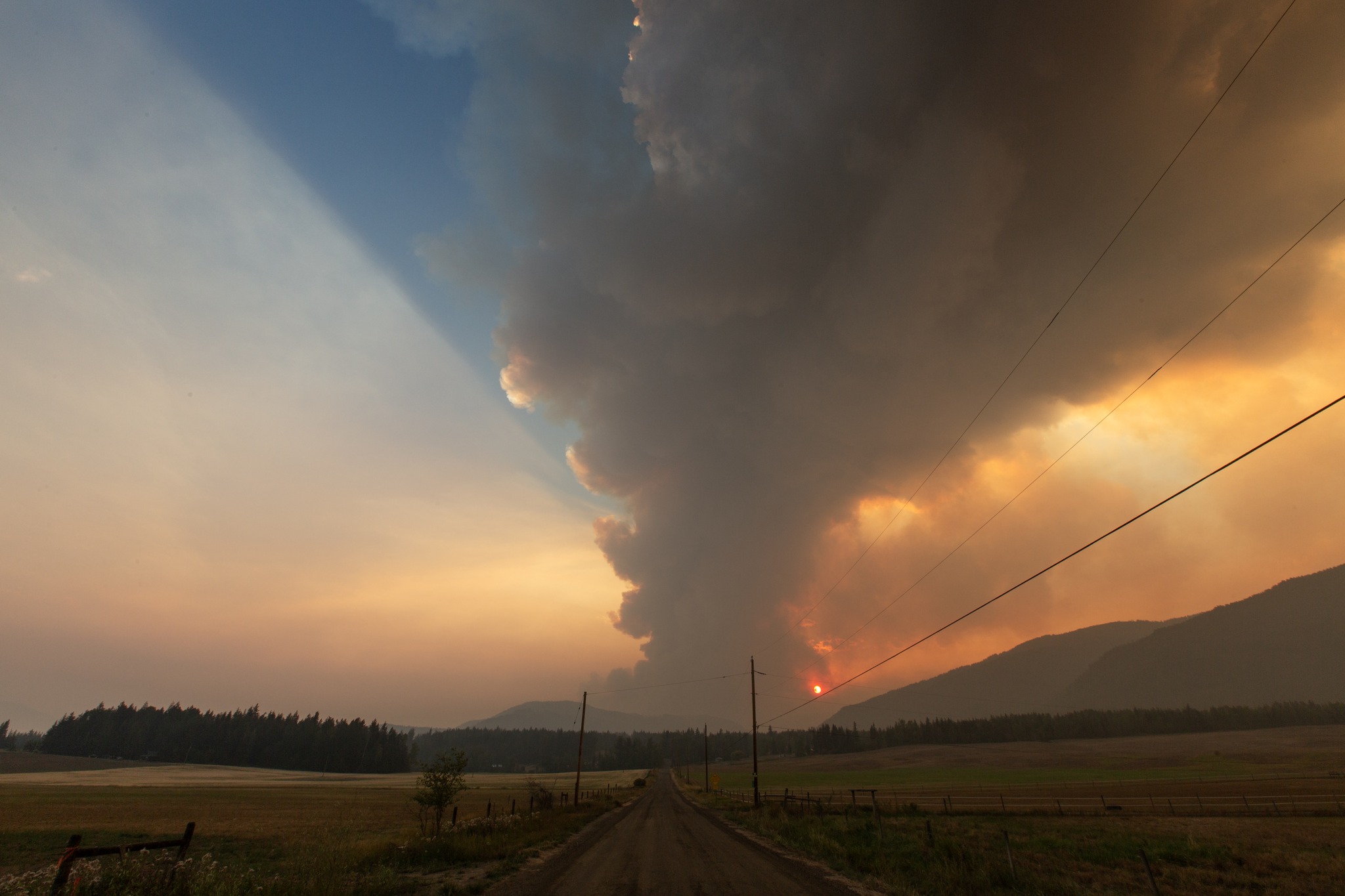
Aug. 17th at 7pm from Line 17th on the bench above Celista looking towards Scotch Creek at the fire
approaching from the west, photo by Janis Smith
[This article appears in the Sept. 23, 2023 Victoria Times-Colonist]
Most North Shuswap residents struggle to comprehend how the BC Wildfire Service can claim their controlled ignition was a success that “saved hundreds of homes” when it is blatantly obvious to them that this backburn was responsible for destroying 176 houses, cabins and structures and damaging 50 more. I was a witness to the disaster, as we live just two kilometres south of the powerline where the 10 km long controlled burn was lit with an aerial ignition at 4 pm on August 17, 2023.
One hour later we saw a massive mushroom cloud of smoke rise above the hills behind us. We were aware of the planned ignition, as we had watched the 2 pm BCWS press conference, at which BCWS spokesperson Forrest Tower explained that because a strong windstorm was forecasted to arrive from the northwest at 11 pm, they would take advantage of the current southernly wind to ignite a controlled burn to remove the fuel between the powerline and the existing fire. But by 6 pm those winds arrived and began blowing a massive amount of smoke to the east.
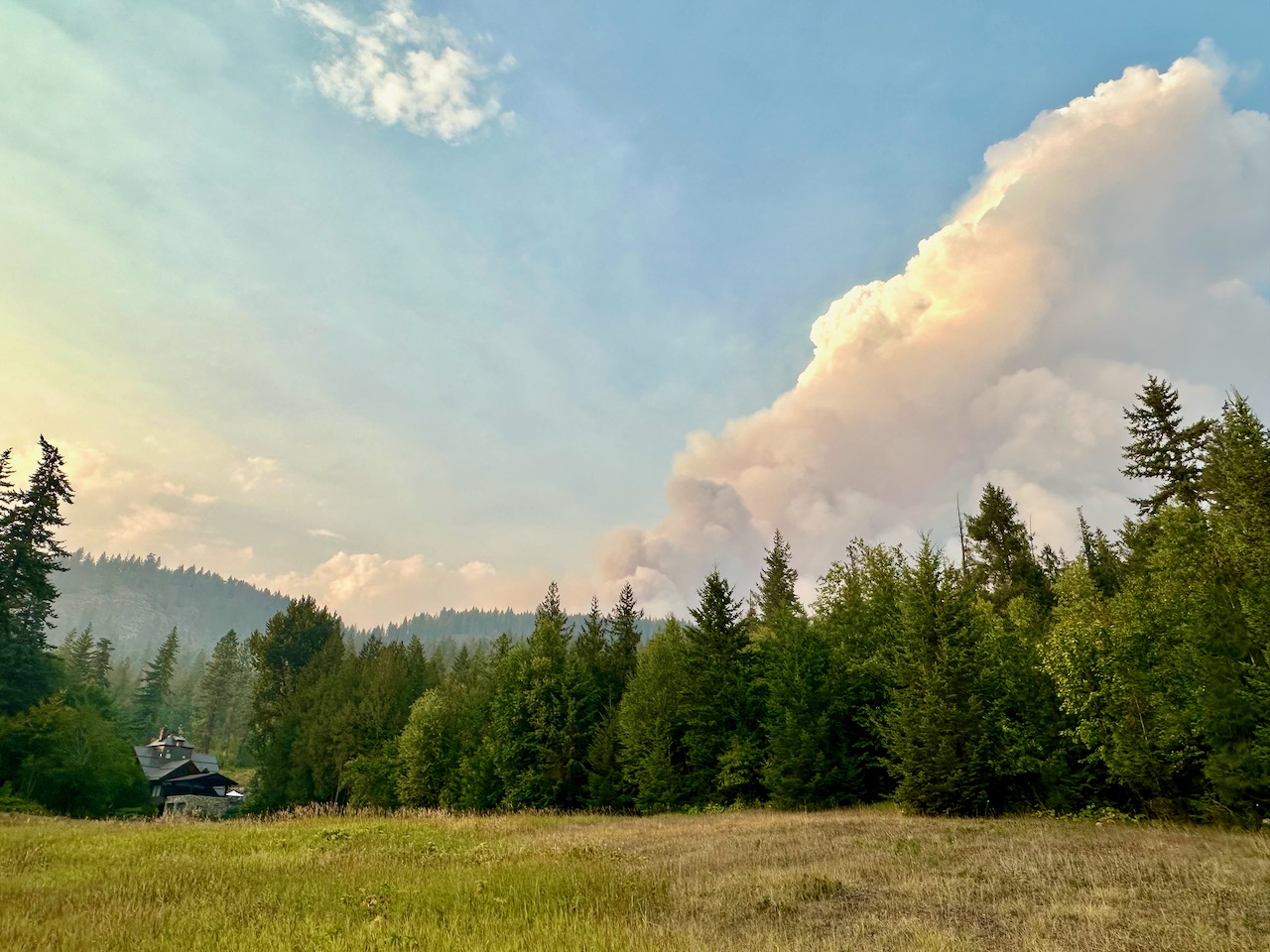
That night residents on the south shore of Shuswap Lake witnessed a massive fire above Lee Creek spreading east towards Scotch Creek. Meanwhile in the Meadow Creek Valley above Celista, local farmers had to work feverishly to protect their properties after the fire jumped Scotch Creek that evening. Shortly after noon on the following day, residents witnessed the fire quickly moving down into the community of Scotch Creek. Yet, the Columbia Shuswap Regional District (CSRD) did not issue an evacuation order until 2:16 pm, leaving little time for residents to leave.
Fortunately, we received a phone call about the fire and left shortly after 1 pm, but by the time others were ready to leave, the fire had engulfed the only paved road out and thus they had to evacuate either by boat or by driving the long, dusty logging road to the isolated community of Seymour Arm. It was not until 4:13 pm that the CSRD issued the evacuation order for Celista and by that time many of the homes there had burned down. It was a miracle that no one died.
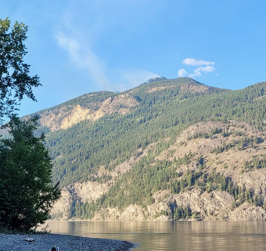
There were two fires that ignited on July 12th from lightning strikes above Adams Lake on the west side and the east side. A few days later, BCWS used skimmer planes in an attempt to control these blazes, but their primary strategy for the fire on the east side was to monitor it because it was in rugged terrain. Both fires grew steadily, and when the fire on the east side moved down the mountain to threaten homes and cabins at Adams Lake, BCWS was forced to bring in more resources as residents left by ferry.
On the day of the disaster, the fire on the west side also turned into a firestorm and soon engulfed the field where BCWS had their camp for approximately 300 firefighters, before it destroyed 85 homes and businesses in Squilax and then jumped the Little River into Sorrento and Turtle Valley. As their tents were ablaze, they too evacuated and were nowhere to be seen the following day, leaving those residents who stayed to fight fires. It took five days before the BCWS made it to Celista and yet the CSRD used police to enforce the evacuation order, making criminals out of the local heroes who saved countless homes and properties.
Since the firestorm, I have been collecting evidence that clearly shows how the backburn exploded and devastated our community. Photos show the smoke blowing east and the fire’s movement into the community. A satellite image and aerial photos of the burned area clearly show how it was the backburn and not the original fire that turned into the horrific firestorm. A fire expert has also explained how one giant fire creates its own weather and can pull an adjacent fire towards it, which explains how the fire on the west side also exploded and jumped over the Adams River to burn much of Tsútswecw Park.
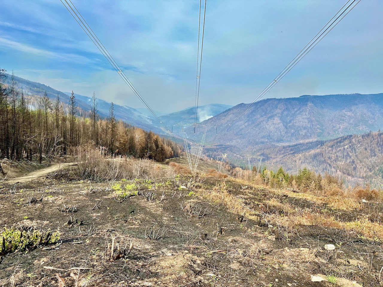
One month after the failed backburn, I journeyed up to the powerline to see firsthand how the firestorm took off. At the west end, it crept under the powerline in Lee Creek canyon before climbing the hills and moving into the small community above us where it destroyed 10 homes. To the east, I saw the remains of where BC Hydro had slashed the powerline in the spring and left the dry brush, which had quickly ignited and helped spread the flames to the east. The view from the top of the hill above the Scotch Creek canyon was a horrific scene as the burnt forest stretched as far as one could see and there was still smoke billowing in the distance from multiple fires.
The drought this summer has made the entire province a tinderbox, and already more the 2.4 million hectares of forest has burned, which is over three times the previous record set in 2021. We are in the midst of a climate “boiling” emergency, and yet the BCWS does not have the resources available nor the mandate to extinguish fires when they first begin. Plus, they are likely now responsible for devastating a community with an uncontrolled burn lit before a windstorm. Clearly, there is a need for major changes, as this province has yet to implement the recommendations from previous firestorm reviews, and there must be a full public inquiry into the 2023 Shuswap Firestorm.
Download the pdf file of this article, along with all the photos and maps here