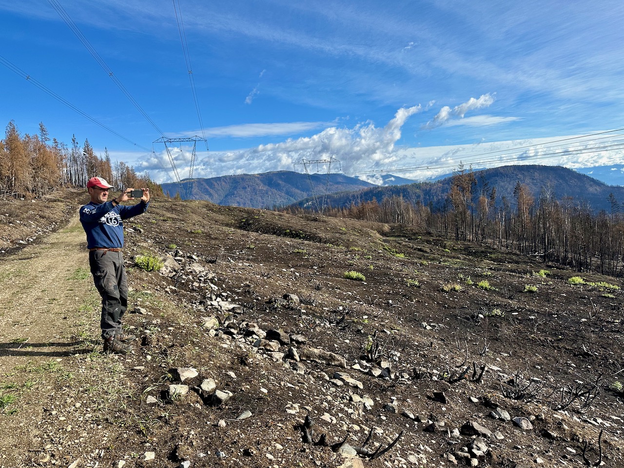
On October 4, 2023 I invited wildfire expert Bruce Morrow, who has 35 years of prescribed fire and wildfire suppression and management experience, to tour the powerline above Lee Creek to see where the BC Wildfire Services aerial ignition took place on August 17th and subsequently escaped into North Shuswap communities causing extensive damage. He subsequently prepared the following assessment, which has been shared with various media outlets.
Initial Assessment of Large Burn Off in the North Shuswap [Draft]
August 17, 2023 on Fire K2-1633
Prepared by: Bruce Morrow R.P.F. (Ret.)
October 8, 2023
Bruce Morrow has over 35 years of prescribed fire and wildfire suppression and management experience. He was asked to review the video footage, B.C. Wildfire Service media reports and documents produced by Jim Cooperman relating to the burn off on K2-1633 on August 17, 2023 (Fire number as of October 8, 2023). A subsequent field trip on October 3, 2023, was completed along a majority of the hydro line used as the main fuel break for the ignition.
This assessment only relates to the burn off itself, no other wildfire suppression activities on the wildfire. Comments are limited to the information provided, including video and photo documentation and the on-site visit. Comments are related to the burn off and how it meets the basic principles of controlled burning in the province of B.C.
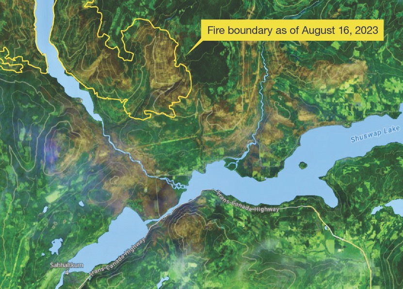
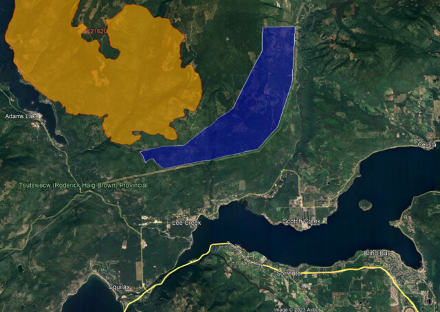
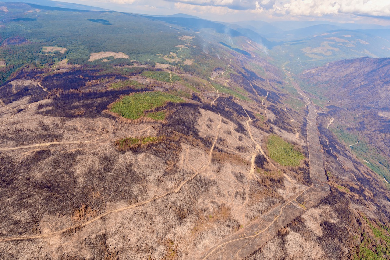
A burn off was conducted to the north of the hydro line, north of the community of Lee Creek and wrapped around into the Scotch Creek drainage. The burn off on K2-1633 fails to meet the basic standards and principles of controlled burning in at least five ways.
- Incomplete control lines
To conduct a controlled burn, the entire area planned for ignition must be surrounded by control lines, non-burnable surfaces, natural or man-made, that can be used to control fire spread. Neither the west nor east end of the burn off had any identifiable control lines. To be conducted properly, each end of the burn line would have had to have control lines tied back to the wildfire edge. These control lines should then be used as part of the ignition. This was not done. The only control line was the hydro line on the southern perimeter. Both ends of the ignition were uncontrolled. In addition, the Lee Creek draw was within the burn off area but had no control line across it and was not burned. Both edges of the draw were ignited allowing the burn off to spread down into the draw and then south under the hydro line. This was not a controlled fire.
- Burning in Front of a wind event
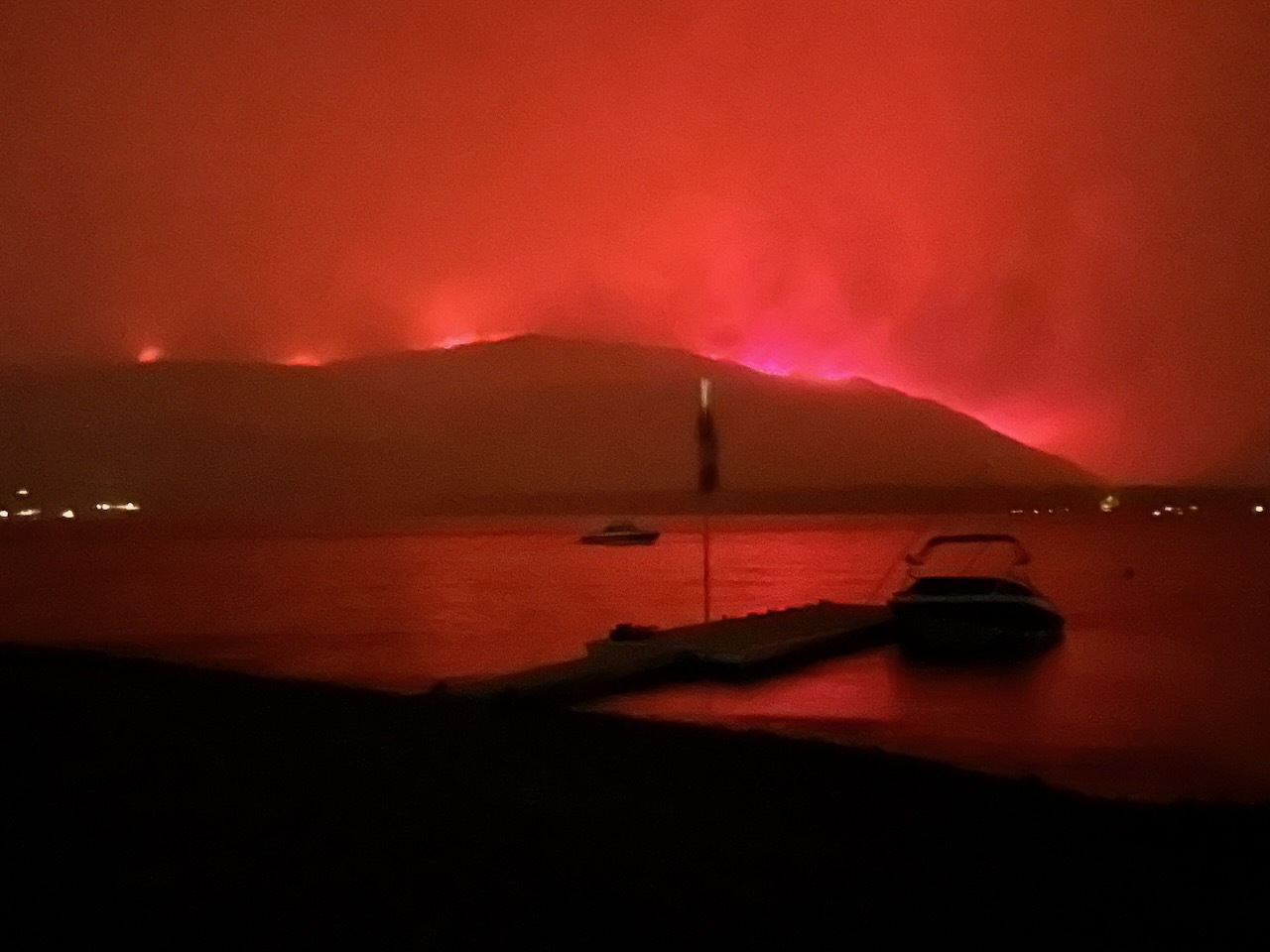
A very fast-moving cold front was forecast to hit the burn area within a few hours of ignition. The predicted winds were to push the burn back onto the hydro line. Favourable burn conditions were only available for a few hours. After which, the burn off was going to be subject to strong winds that would direct the burn off without any control. There was not adequate time to complete the burn and have it consume the fuels between the burn off and the main fire before the wind event occurred. Photos on the evening of August 17th show the wind event pushing the smoke column created by the burn off to the east, over Scotch Creek. The burn off was ignited knowing, or should have known, that loss of control of the direction and rate of spread would occur within hours of the ignition.
- Ignition Pattern Made Fire Too Hot
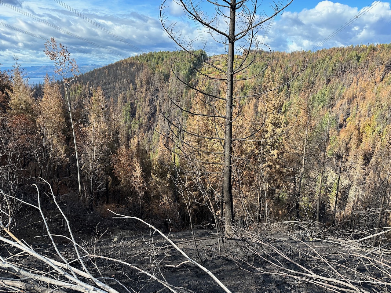
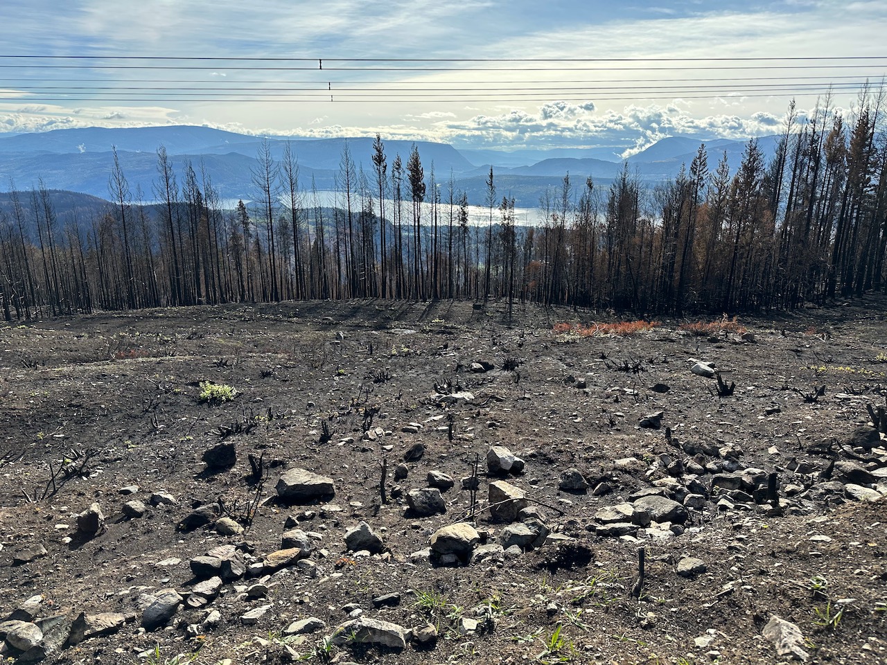
The ignition pattern was one strip along the north side of the hydro line. Video shows the line approximately 20-50 meters above the hydro right-of-way. The burn off was allowed to spread uphill along a roughly ten-kilometer front. This type of ignition creates a high intensity headfire, the most aggressive type of fire possible, with the slope and wind pushing the fire uphill. The burn off was far hotter than the wildfire, from smoke output shown on the video and photos provided. Burn offs are supposed to be pulled towards the main fire by the heat of the main fire. The burn off was far hotter than the main fire so there is no sign of this occurring. If anything, the burn off would have pulled the fire towards it. The burn off created the hottest portion of the fire along the edge of the burn off. Immediately above the hydro line.
- Too Large a Burn Off Area
The burn off was meant to cover 2600 hectares of timber between the hydro line and the main fire. The equivalent of roughly 5000 football fields. With the ignition patten used, there was almost no chance of this area being consumed before the wind event occurred and burn off control was lost. Attempting to burn 2600 hectares in one afternoon with a single strip ignition lighting pattern is not a successful burn off strategy.
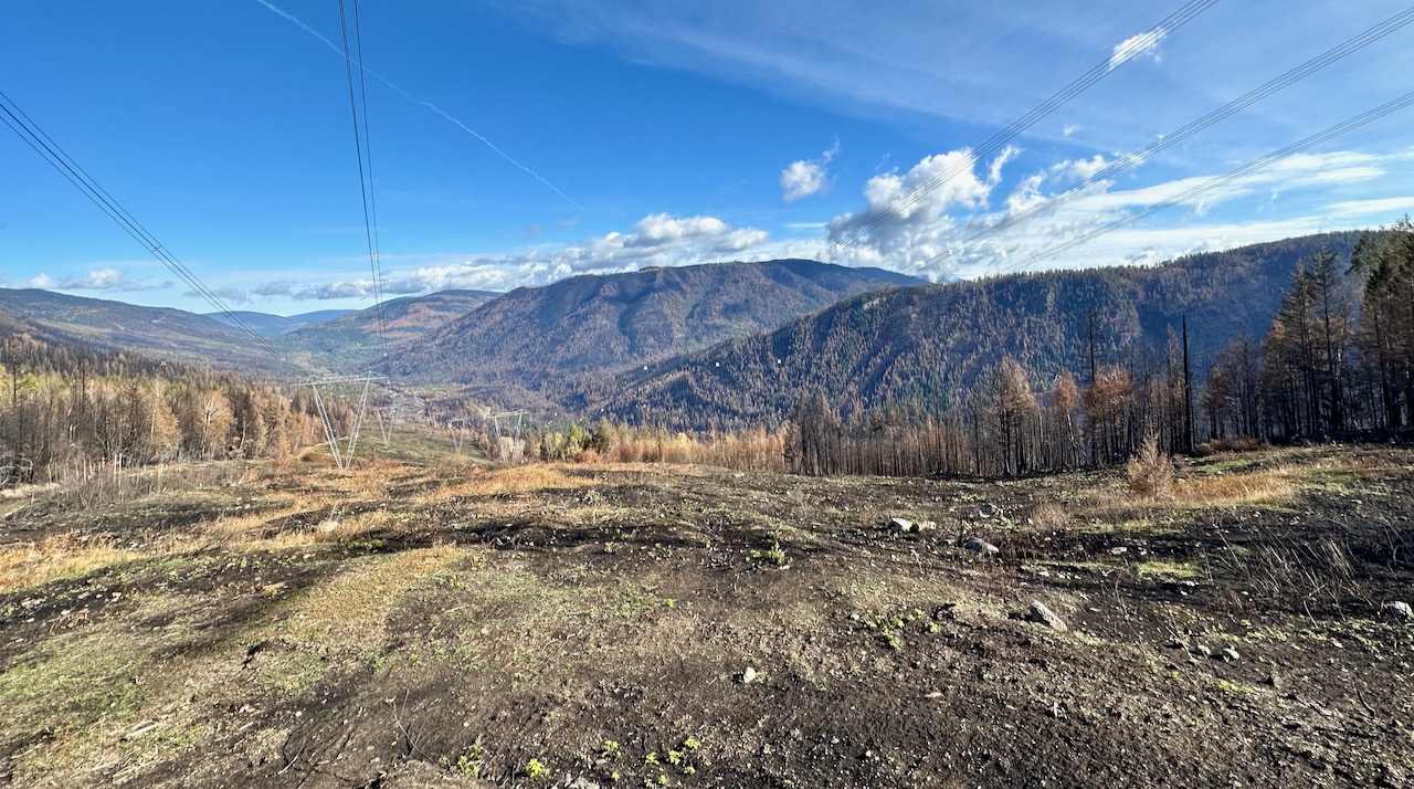
- Poor Fuel Break
The hydro right-of-way, or more specifically the narrow road/trail along the right-of-way was the only control line for the burn off. The trail measured 4-7 meters wide along its length. As noted in 1, the control line did not extend across the Lee Creek draw. Where the hydro right-of-way was dominated by heavy brush, the control line was effective. The green deciduous brush did not support wildfire spread and supported the control line effectively. The eastern portion hydro line had been recently slashed of the deciduous brush, creating a continuous cover of very dry brush and grass (effectively kindling). In this area the entire right-of-way burned and allowed the fire to spread south and east. Forty meters of dry brush behind a 4-7-meter-wide control line is not an effective fuel break.
Summary
The burn off on August 17, 2023 on K2-1633 did not meet the basic principles of a controlled burn. The lack of complete control lines, the known wind event that would alter the burn pattern, the maximum heat ignition pattern, the large area planned for ignition and the poor quality of the available fuel break all resulted in an uncontrolled burn off. This was a very high-risk activity with little chance of success under the extreme conditions on August 17th.
POSTSCRIPT