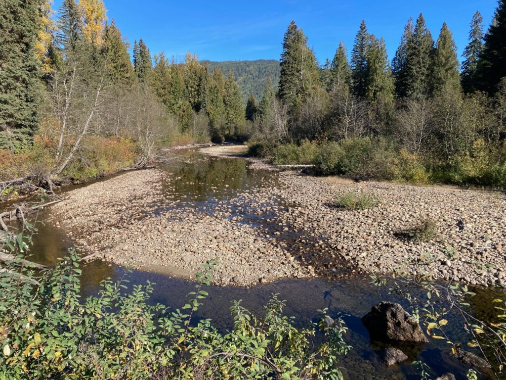
Last week we headed into the North Shuswap backcountry with trepidation to determine how badly the forests burned last year in this key recreational area. Heading north from Albas, we could judge the severity of the current drought by the low water levels in Celista Creek, which was reduced to a trickle.
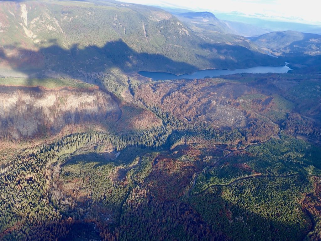
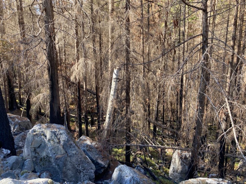
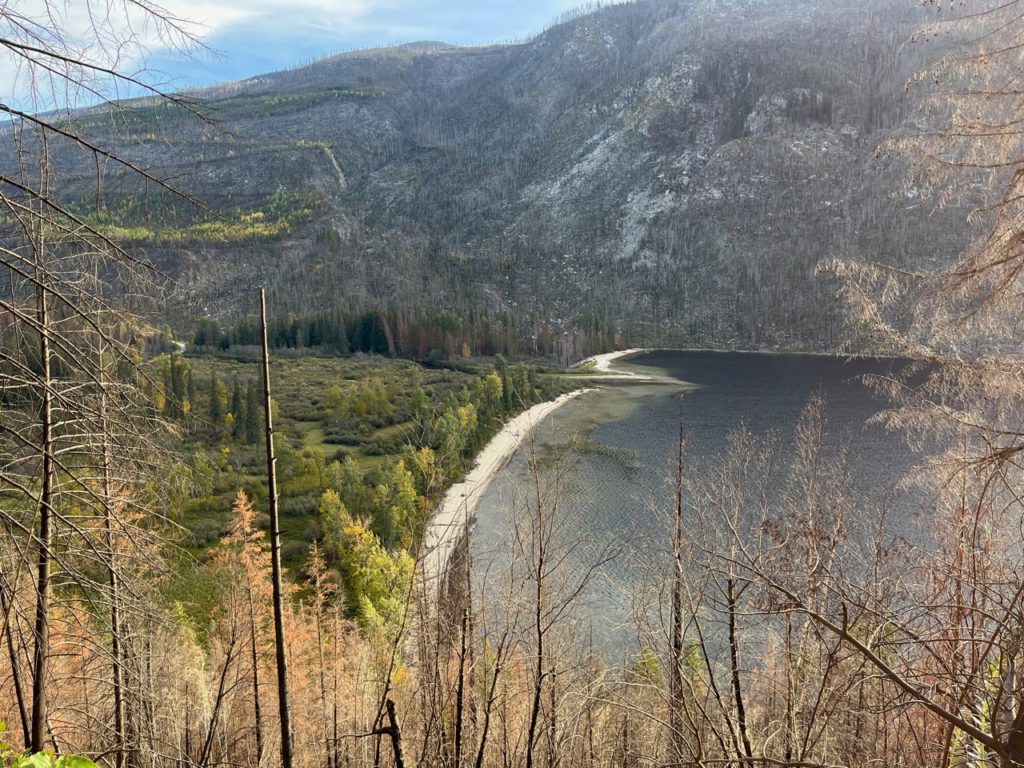
Heartened by the still green forest surrounding the eastern end of the land where the campground was intact, we carried on along the well-maintained logging road to the middle of Humamilt Lake where there was little left on the hillsides above the south side of the road. Where the trees have been salvaged, all that remained was blackened stumps, burnt debris, dry soil and ashes. Massive piles of unusable charred logs and branches await to be burned once the snow comes.
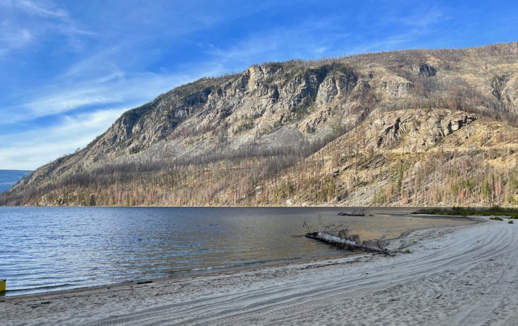
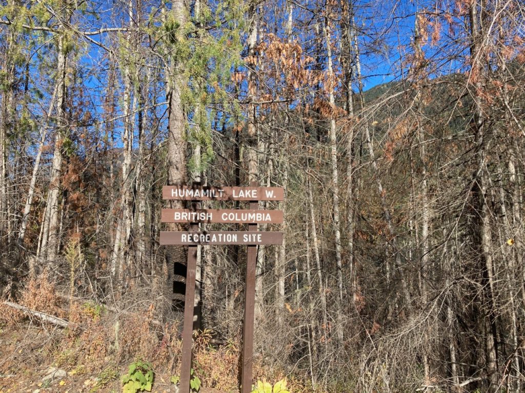
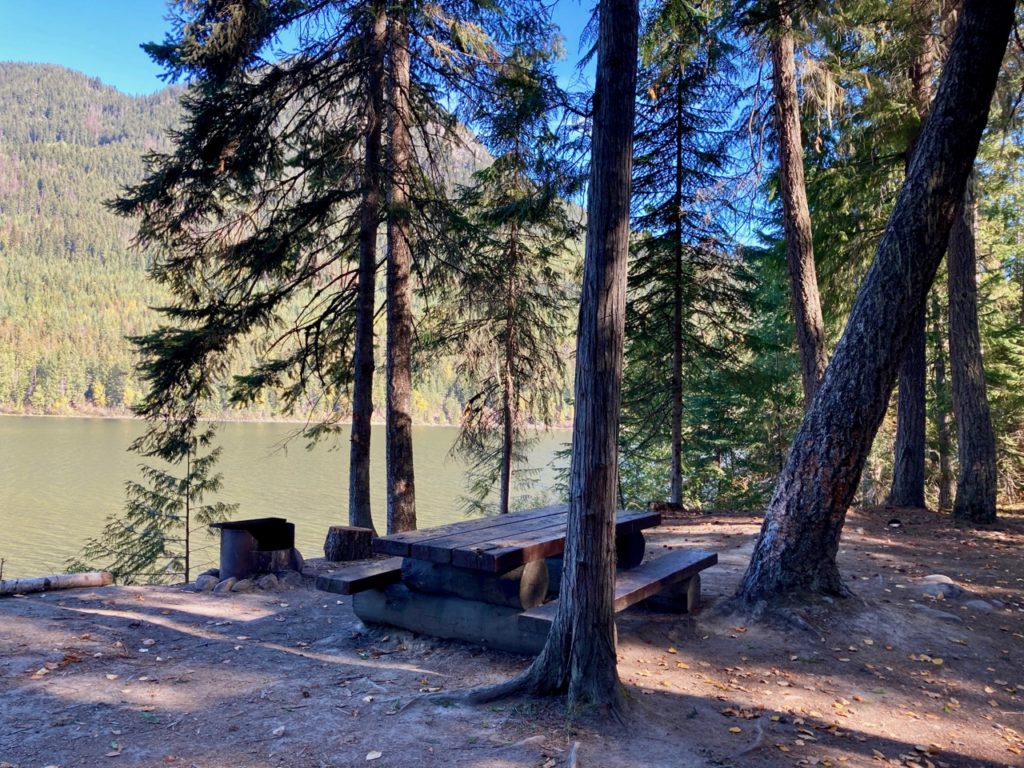
It was not until nearly the west end of the lake that the fire crossed the road to burn all the way to the lakeshore. But fortunately, the fire petered out inches away from Humamilt Lake’s best recreation site, where there are six campsites and a boat launch. The lack of fuel on the forest floor was likely one of the reasons it was not destroyed. According to the website, this site is closed due to the fire, but it was apparent that it had been used this summer.
Heading west, we found that Stukemapton Lake where there is one small recreation site, largely escaped the flames. Further to the west is now a deactivated road that forks to the north into the Cayenne Creek valley. This valley, which burned completely in approximately 1930, has now been first pass logged and rather than continue maintaining it, the government pulled out the culverts and shut it down.
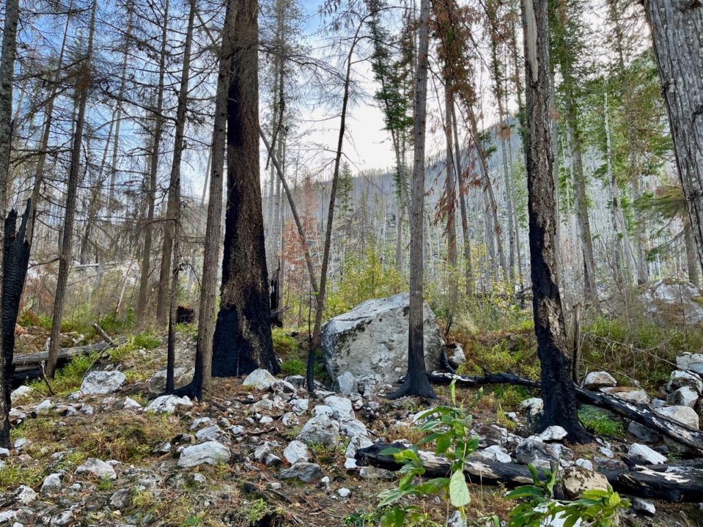
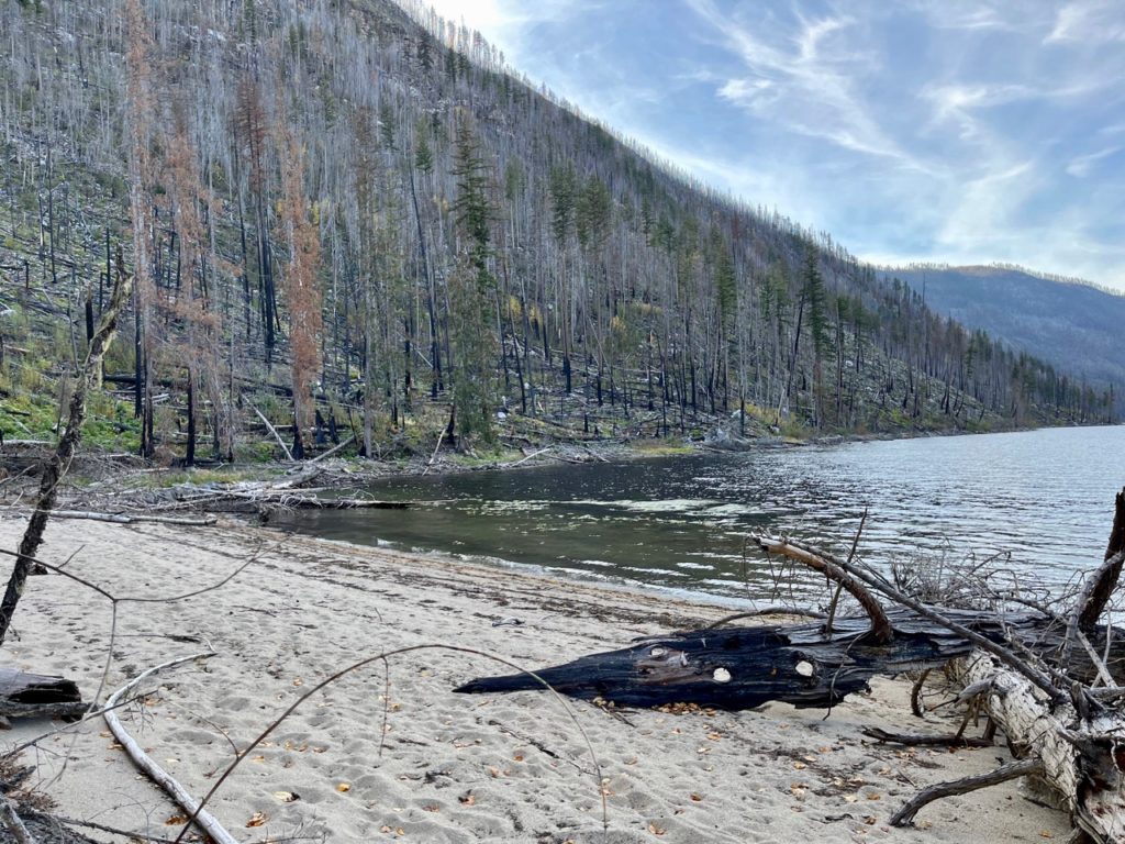
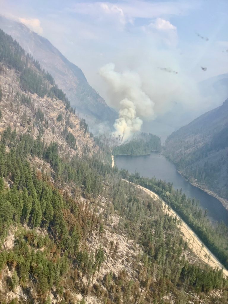
Part way down the hill to Momich Lake, the landscape turned black and grey once again, as the fire had raced up the usually damp Cayenne Creek canyon past the scenic waterfall, destroying every green plant and tree, including old growth cedar trees and thick moss. We fondly remember hiking to the waterfall to fish in the pools and marvelling at the ancient green forest. Today, the scene here is more apocalyptic, as even the soil has fried.
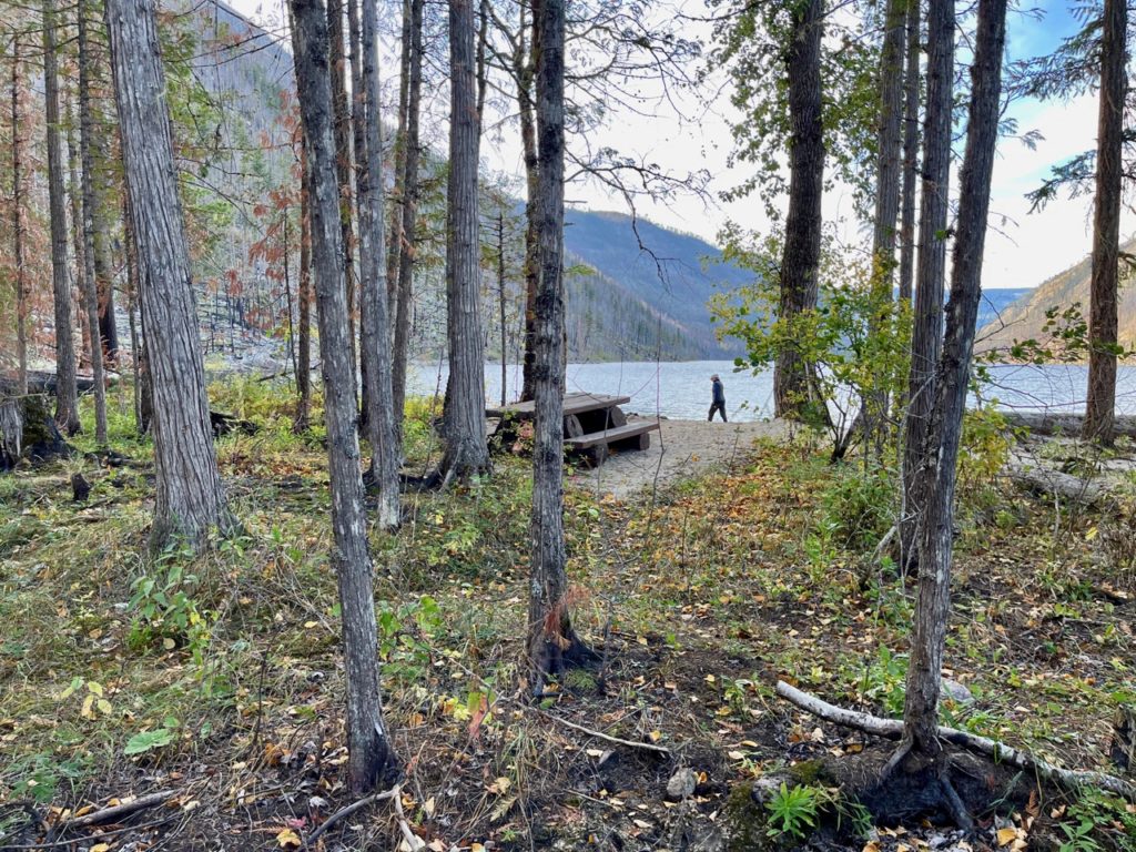
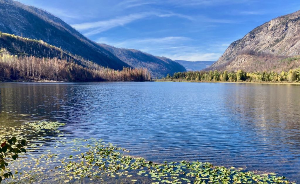
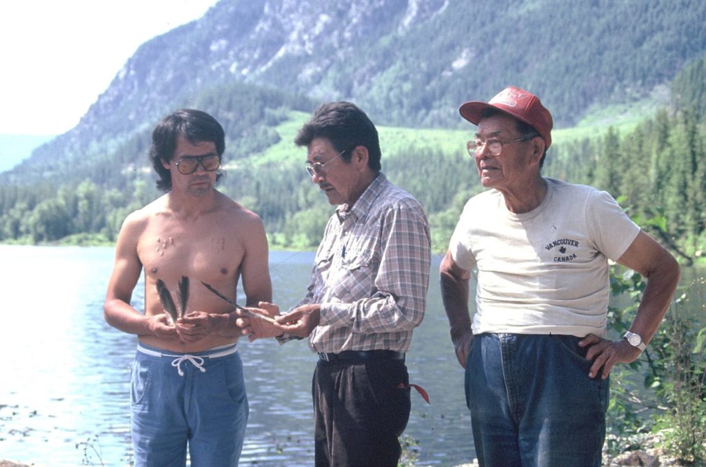
Momich Provincial Park includes three lakes connected by a tiny river. The first time I canoed and camped on Momich Lake was in 1976 when there were no roads and we had to portage into the first lake, then portage again along the river to the second lake. I returned many times to camp and canoe there, and once brought Secwepemc elders and chiefs there to examine the unique pictographs on a massive boulder on the shoreline of the third lake.
Fully aware of the park’s scenic features and the great campsites at the east end of the middle lake, I successfully negotiated park status for it during the Kamloops TSA land use planning process in 1994. With most BC Park funds directed to parks in the lower mainland and those closer to communities, no new infrastructure was added to Momich Lake and one of the forest recreation campsites was closed. Tragically in 2009, the park experienced its first large fire, which destroyed much of the surrounding forests.
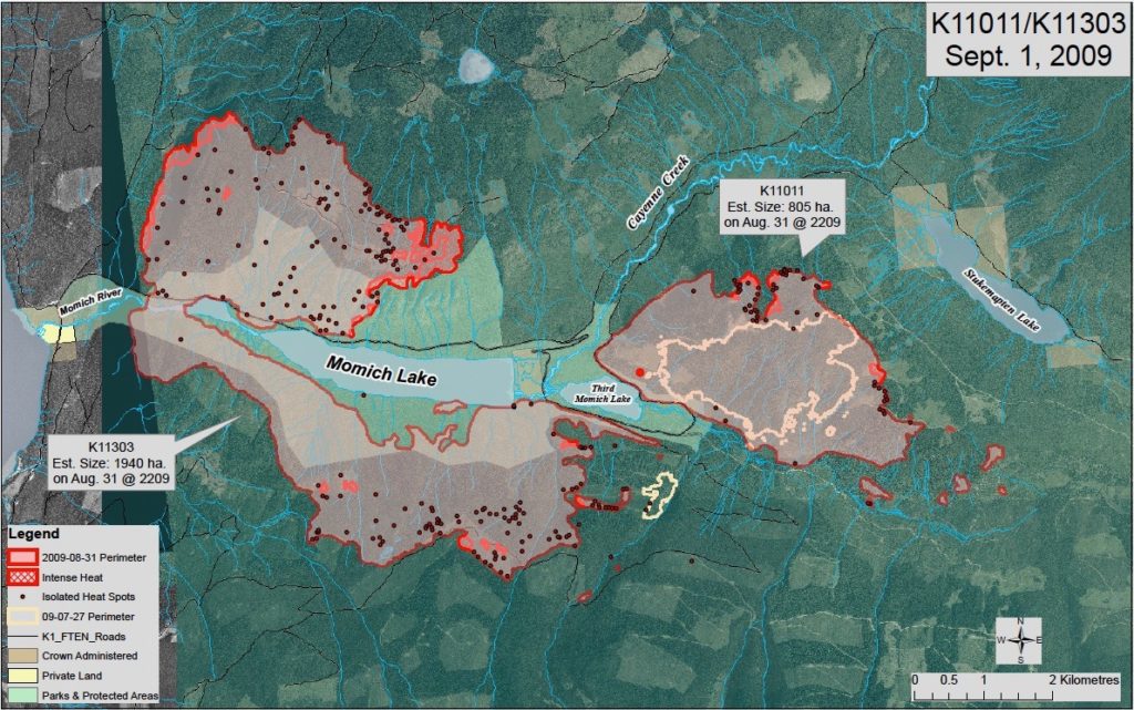
Last year on July 7th lightning struck the hillside above Adams Lake, which quickly exploded to 500 ha by that evening. For the first few weeks an Interfor crew fought the fire with limited resources, while the BC Wildfire Service concentrated on another lightning strike fire to the north. Despite their best efforts, these two fires merged and headed east. Eventually, the fire swept eastward all the way to Humamilt Lake. By the time it was extinguished, the fire had burned a total of 17,049 ha and stretched from north of Adams Lake, south to Pukeashun Mountain and east to beyond Humamilt Lake.
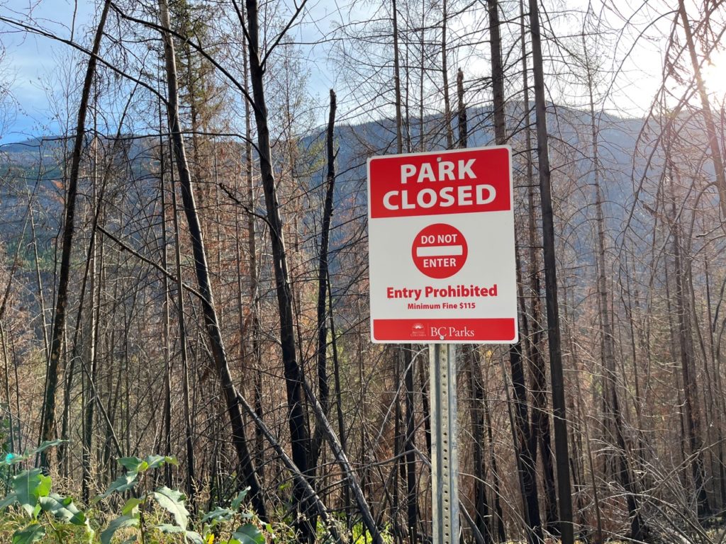
Momich Lake Provinical Park has been officially closed since the first fire and despite a sign posted that threatens anyone who enters it with a minimum $115 fine, people continue to camp there. The road is also technically closed to recreational visitors, but with no enforcement it continues to be used by hunters and campers. Ideally, the dangerous snags should be removed, and trees planted so that the park can be re-opened.
POSTSCRIPT
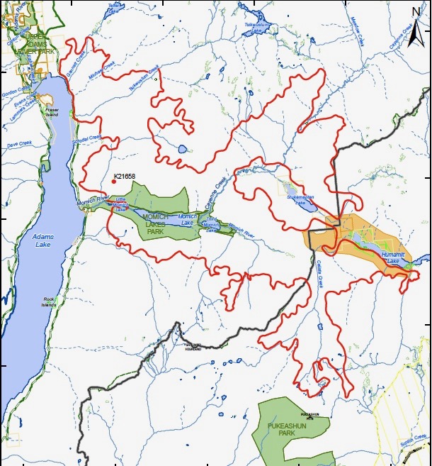
It was a massive fire and there was a concern that it would extend all the way to Seymour Arm and join up with the Hunakwa Fire, but fortunately, after burning for some two months, the weather finally changed with the rain ending its growth.