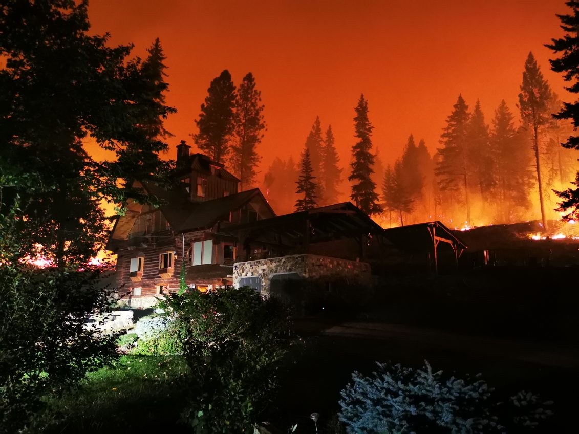
During the firestorm, a brave neighbour drove up the road to check on our place and took an amazing photo above of the hillside behind our home ablaze, yet the fire never went past the area that had been watered. This successful protection of our home should serve as a prime example of why everyone who lives in rural areas needs to do fire proofing to protect their homes
August 21, 2023
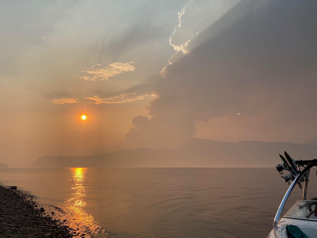
A fire caused by lightning started above the west side of Adams Lake on July 12th, grew slowly then initially exploded on July 20th due to a windstorm. Early in August, it moved down the hillside and if not for a huge effort by firefighters it would have destroyed homes and cabins along the lake. The fire continued to grow due to the winds and edged further southeast towards the North Shuswap community of Lee Creek, in the North Shuswap. By the second week of August it was about 6 km away from properties. When the weather report indicated that a strong northerly windstorm would hit on the evening of August 17th, the BC Wildfire Service made the extremely risky decision to use a controlled burn (a backburn) to reduce the fuel load in front of the fire.
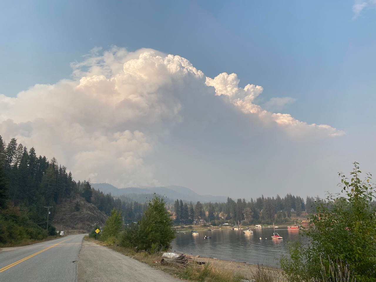
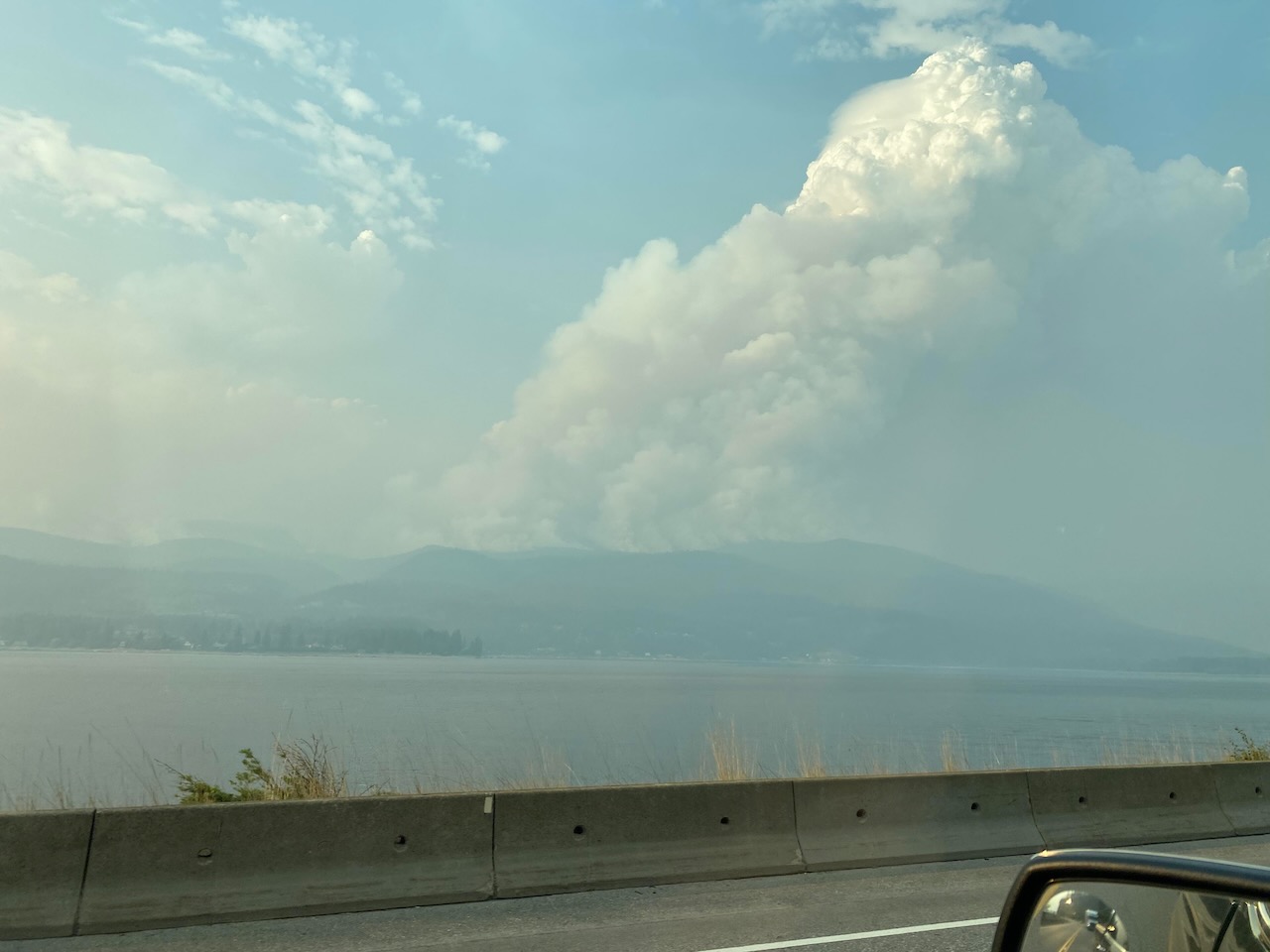
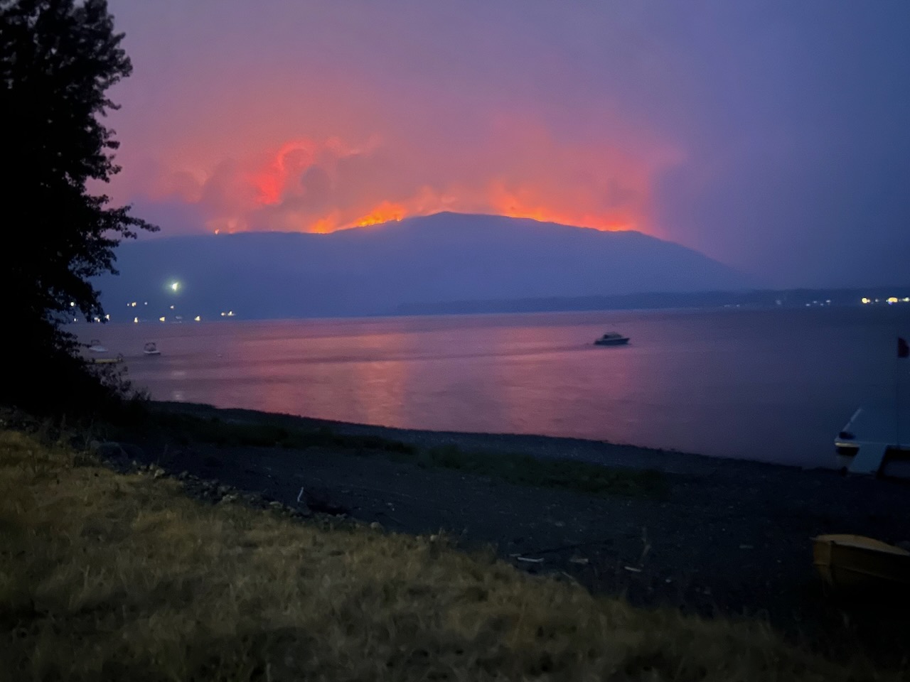
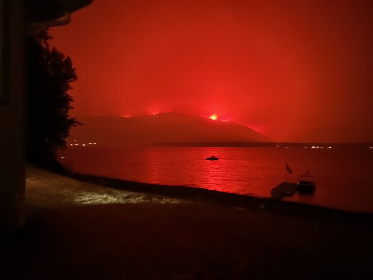
They lit the backburn using a helicopter and ping-pong balls filled with sodium nitrate and anti-freeze. It was a massive fire that produced a giant mushroom cloud of smoke above the hills above our home. The next day the strong winds blew the combined fire down to Lee Creek, Scotch Creek and Celista, destroying 176 homes, cabins ,and businesses and damaging 50 more.
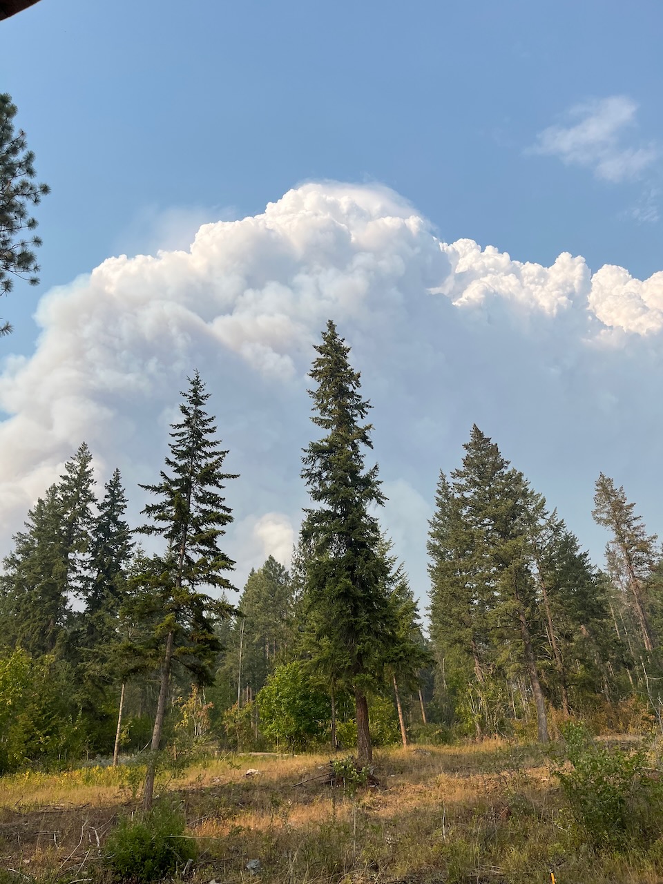
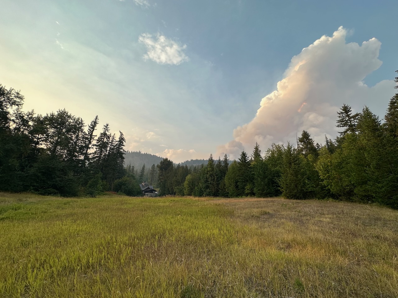
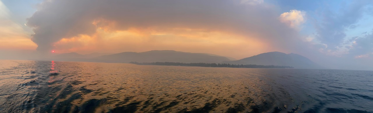
The weather created by massive backburn fire may have impacted the fire on the west side of Adams Lake below the lake creating a firestorm that blew into Squilax, forcing the evacuation of the fire camp in a field and then destroying a gas station, homes and many cabins. It jumped across the Little Shuswap River and then destroyed homes north and south of the Squilax Bridge before moving up Squilax Mountain, east to the hills above Sorrento and south into Turtle Valley. This end of the fire continues to threaten the South Shuswap, Skimikin, Sorrento and as far away as Tappen.
This fire remains an ongoing disaster as there are spot fires everywhere and the fire is continuing to advance slowly eastward. Here are my notes for a number of recent media interviews:
- BCWS is ultimately responsible for the mess
- Did not adequately respond to the fire when it began
- Response waited until it grew and nearly burned houses at Adams Lake
- In a drought, fires are nearly impossible to put out or stop
- The backburn backfired – it was lit too far from the fire and too late as the northerly windstorm was only hours away – it increased the fire size and then it blew across Scotch Creek and into the hills above Celista – plus the fire creeped through the Lee Creek canyon underneath the powerline
- The evacuation order came too late. We could see the fire creeping over the ridge behind us and were told the fire was at Scotch Creek so we left one hour before the order was given. As a result, people were trapped in east of the Scotch Creek bridge because the fire was on both sides of the road to the west. Some escaped by boat or drove east for 40 km on a logging road to Seymour Arm and then some drove in a convoy for another 50 km on a rough road to Malakwa. There were at least 500 people in Seymour Arm that night.
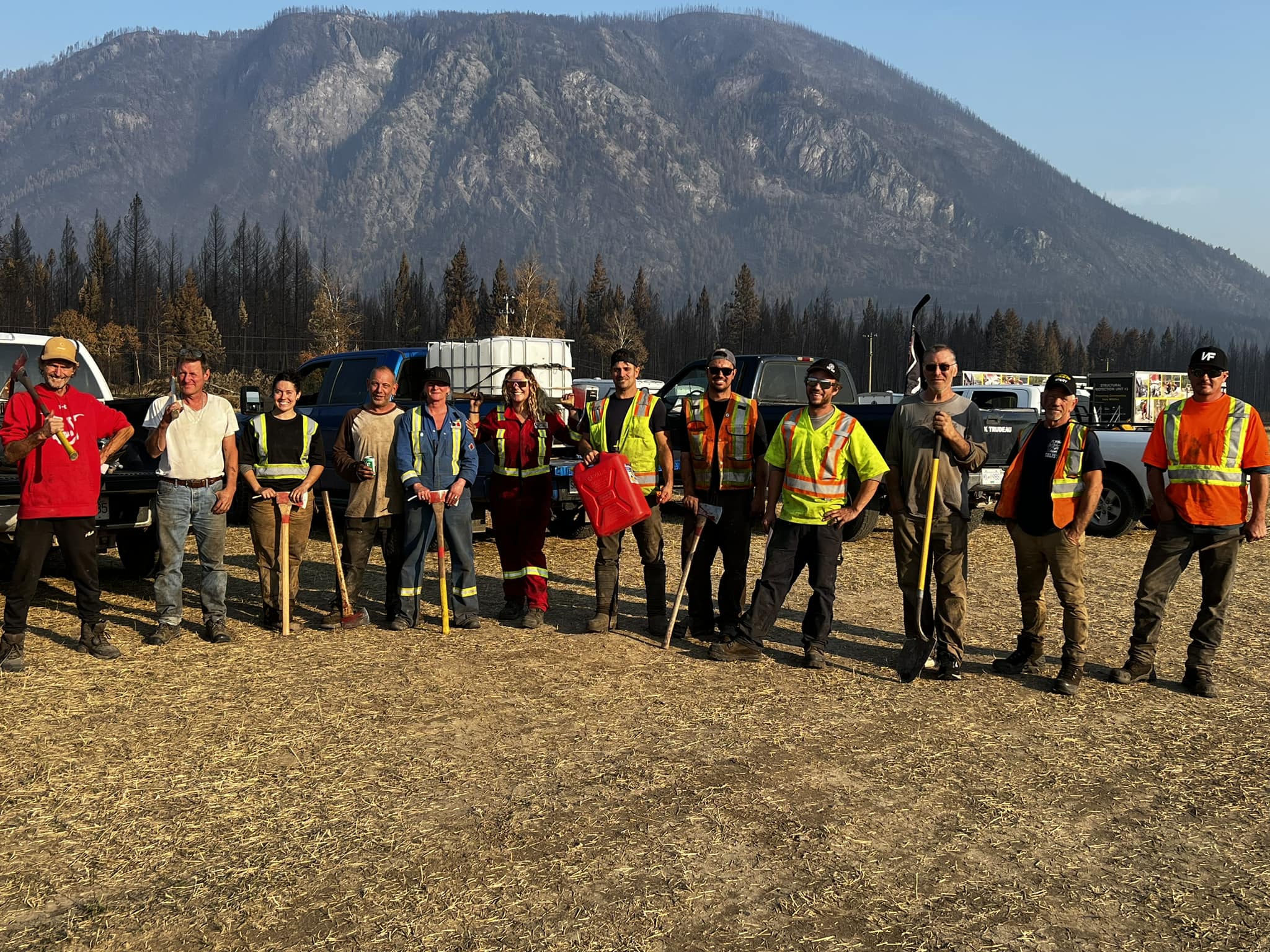
- Currently, it is primarily locals that are fighting the spot fires. Nonetheless, one of our friend’s homes burned down yesterday from a spot fire that no one was able to get to. The local firefighters are loggers and contractors with trucks, water tanks and shovels, working day and night to protect their homes and their neighbour’s homes. They are the real heroes. In addition, there are some fire trucks from all over the province lending a hand. There were three fire trucks in our yard helping – from Vancouver Island, Big White and Scotch Creek.
- Despite the heroic efforts of the locals, the authorities are doing everything they can to stop them. They have brought police up from Vancouver to man checkpoints and stop people from driving in or driving through the community.
- Our Regional District director is one of the local heroes, as he has also defied the rules and remained to help, even working to fight a fire in his community. Yesterday, he was stopped by the police for trying to transport food from a boat to a restaurant where it was to be distributed for free to the locals.
- Due to the roadblocks, locals have been using boats to get in and out and to bring in supplies. Our resilient community has come together in this emergency and will emerge stronger when it is over. Currently, because the police are blocking efforts to bring in supplies, residents are sharing the food from their thawing freezers. Two local restaurants are providing free meals.
- The overall problem is that both the provincial and federal government has misplaced priorities, as it continues to fund oil and gas infrastructure to the tune of billions of dollars, rather than investing in the tools and manpower the country needs to respond to the climate boiling emergency we are faced with. We need fleets of water bombers instead of 30-billion-dollar pipeline.
August 22, 2023 update
The crisis continues to escalate in the North Shuswap today. In the Anglemont community, at the far end of the Squilax-Anglemont Road where there is, as yet, no evacuation alerts or orders, residents are trapped. The only way out is by an approximate 80 km rough logging road to Highway 1 in Malakwa. They cannot drive east because of the numerous police blockades and the police are now using spike belts. They are running out of food and drinking water, have no electricity and the police are blocking everyone trying to bring in supplies.
Contractors and loggers are busy working with the BC Wildfire Service building fire guards with heavy equipment and yet these same contractors do not have permits, cannot receive supplies and cannot drive on the main road. One friend was getting more water to protect his home, then the police chased and stopped him. The made him empty out the water in his truck and grabbed his camera that he was using to film the interaction and deleted the video (he was able to retrieve it from his trash bin). Then they impounded his truck, forcing him to walk home!
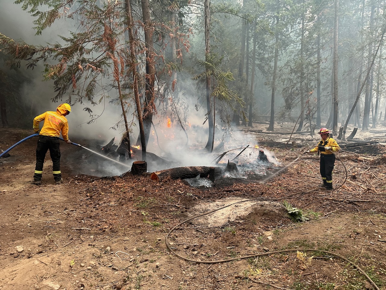
In my community, many of my neighbours remained at home and are using trucks with water tanks, shovels and other equipment to deal with spot fires that keep popping up even after they have been doused. Fire department trucks from all over the province have been assisting, but they leave before dark, leaving the locals to deal with the fires. Last night, after locals and two fire trucks worked on a spot fire near one of my neighbours house, it burned down during late in the night after they finally left to get some sleep.
Yesterday, more BC Wildfire Service personnel have shown up and have been assisting the locals to fight the spot fires. One neighbour had to prevent a crew from lighting another backburn near their home. A helicopter was brought in instead to douse the fire.
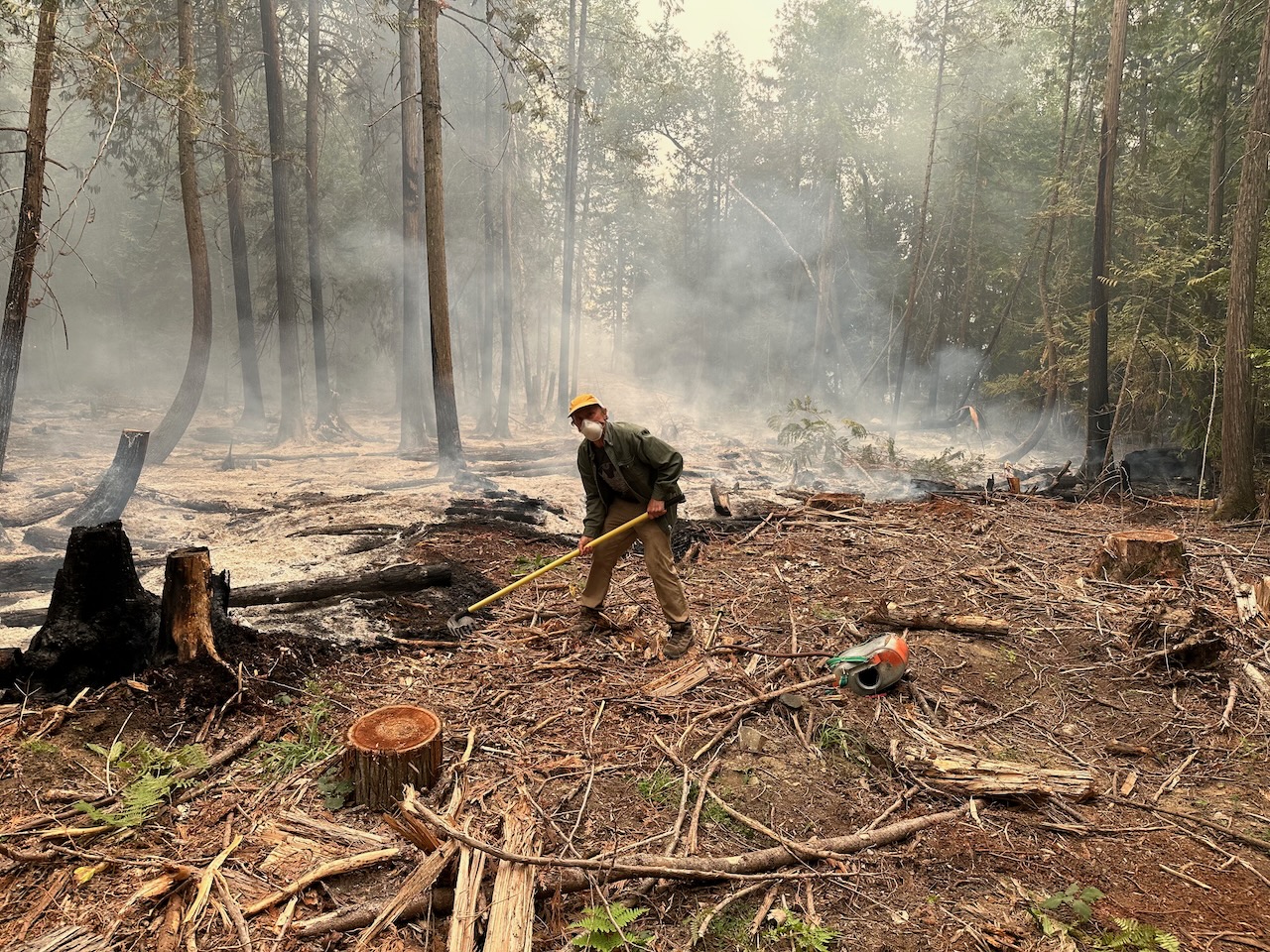
I was able to return to my property the day after the fire swept through and with the help of a young WWOOFer from Germany, we began working on a spot fire that could have burned down our pump house and/or lit the remaining forest on fire and burned down a neighbours house. We used buckets from our pond initially, until a fire department truck arrived. It was doused multiple times and it kept coming back, because it was burning underground in tree roots. One of the many locals with a truck and water tank also came to help. When we finally left near dark, there was another fire truck dousing it. Then late that night it blew up again and the local returned to water it down. This example shows how difficult it is to deal with spot fires, that could continue for months.
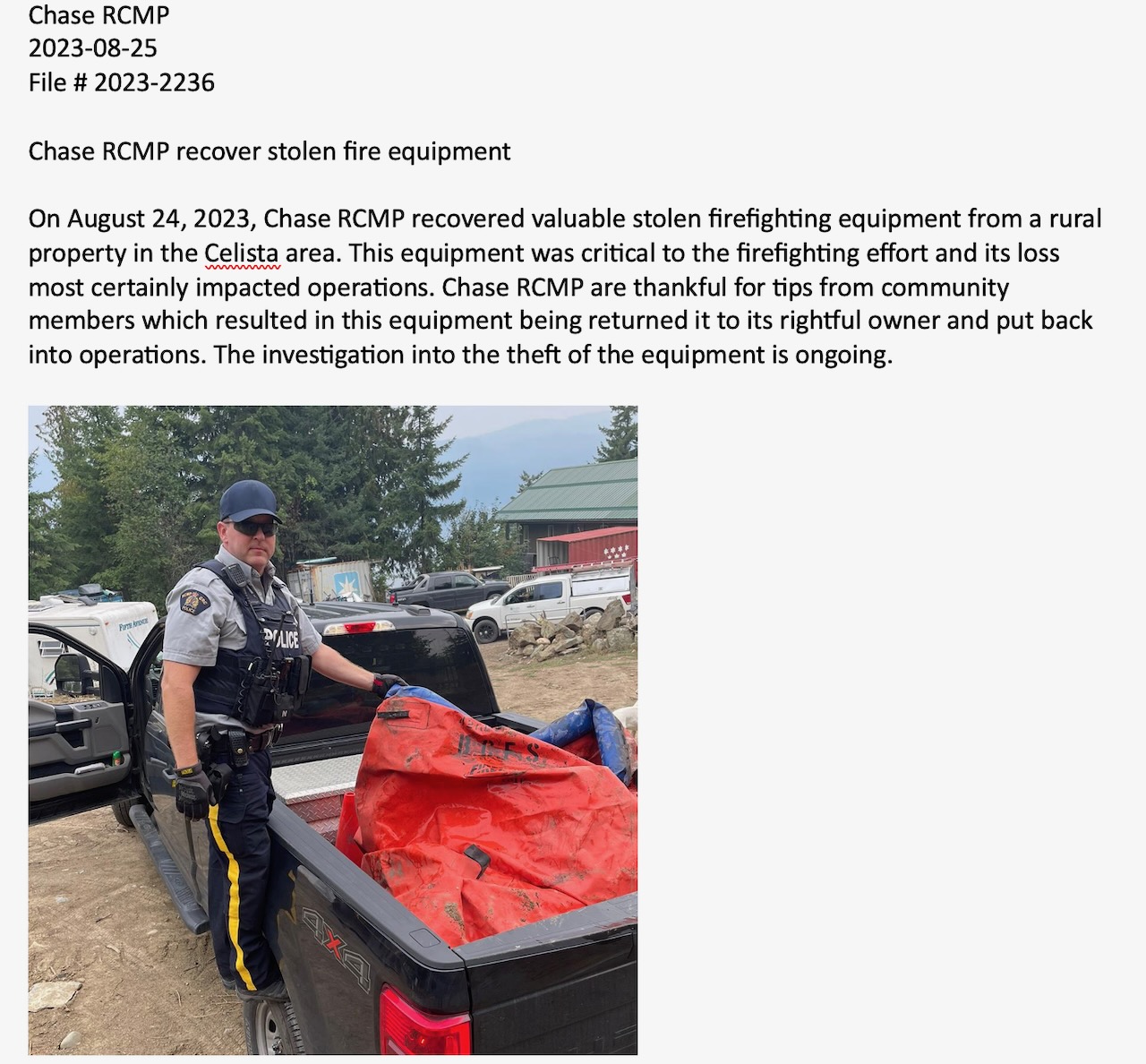
The main news story yesterday that continues today is that equipment used to keep a key bridge watered down was either stolen or “borrowed.” They use this story continuously to justify the heavy police lockdown, yet there many doubts about this story, because no one ever saw the equipment missing. The fire had swept by the area during the Friday night firestorm and there was no longer any threat to the bridge as there were no nearby spot fires and yet they continued to water the bridge. As well, the equipment being used is extremely heavy and would not be easy to take away. It was later revealed that some equipment was stolen by local thieves.
Because of the road blockades and spike belts, the only way in and out is by boat. Many dozens of boat owners have been volunteering their time to ferry people and supplies back and forth from the south shore to the north shore from marinas in Blind Bay and Sorrento and from private docks. Yet now police and conservation officers are out on the lake halting and chasing these boats, with the aid of police on shore using binoculars. As well, police have shown up at the marinas to block this effort.
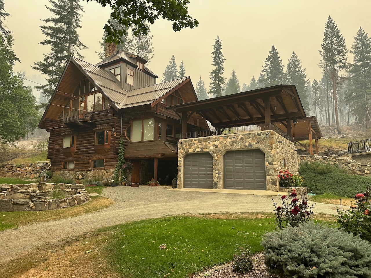
The reason our home was saved is due to the fire smart work we have done over the past few years. We selectively logged our property, leaving most of the largest trees and near our home we removed most of the conifer trees. Knowing how dangerous decorative junipers are, we removed all the ones that posed a threat. On the day before the firestorm, we thoroughly watered the hillside behind our house, as that is where the fire would come from as lawns cover the yard in front of our house.
SEPT. 3, 2023 UPDATE:
The fire has finally stopped expanding, after it exploded above Sorrento a few days ago. There too, local firefighters were instrumental in protecting properties, including the famous Donkey Refuge. In an online town hall meeting on Sept. 3rd, the CSRD explained that they had a rough estimate of a maximum of two weeks before the order is lifted and people can return. There are over 100 BC Hydro staff and countless trucks and equipment in our communities working to restore power. It is working now in Scotch Creek and soon will be restored all the way to St. Ives. It will also be restored likely this week in much of Lee Creek.
The community of Anglemont is no longer “technically” cut-off, as people can leave with a police escort. As well, the CSRD has contracted a local barge to bring in supplies daily. When I asked during the Zoom meeting if the CSRD agreed that changes were needed to address the issue of the order preventing those who stayed behind to be able to travel and get supplies, they explained that the Emergency legislation is now under review and that this review should include this issue. It was clear from the meeting, that the CSRD was following the rules set by the province, yet one might wonder that if they had chosen to be more flexible, would the province have penalized them or would they have simply looked the other way?
Last week, the BCWS set up 10 hour long courses to train locals so they could be certified to work on the fire. Approximately 40-50 have taken the course and sme 25-30 have since been working alongside BCWS crews to actively run hoses and build fire guards. These locals are also getting paid for their 12-hour long shifts. The schedules are designed to be flexible, so they can work the days the want to leave time for fighting fires near their homes and their neighbour’s homes when necessary.
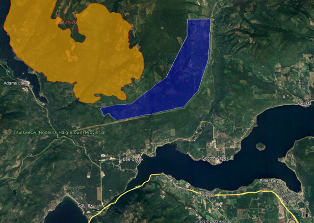
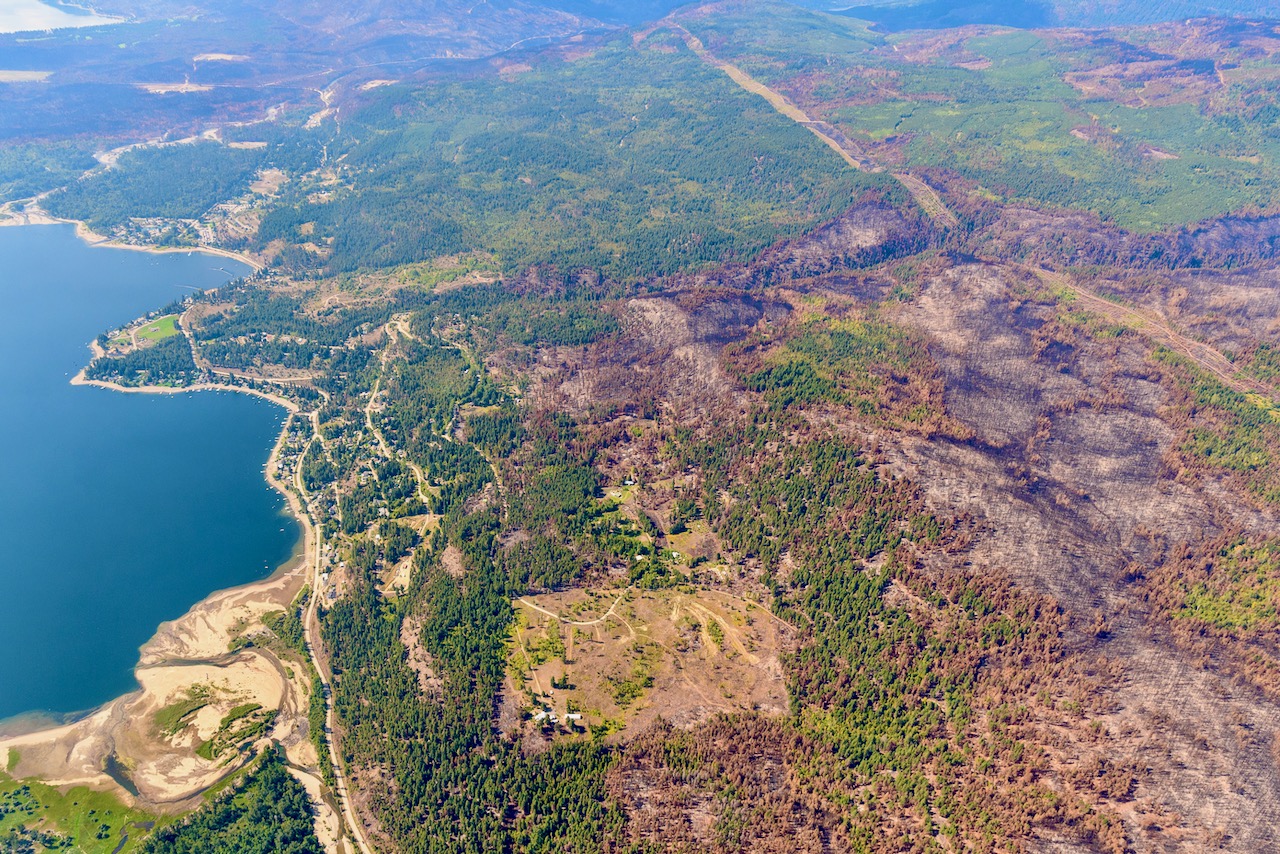
I am working now on collecting data and information about the backburn, as many community members blame it for the massive firestorm that devastated our communities. Approximately 226 homes and businesses were damaged or destroyed. An additional 85 homes and businesses were destroyed in Squilax. The BCWS claims that the two fires on either side of the lake merged, but this satellite image of the burned area from August 25th does not indicate that the fires merged. Compare this image of the burn with the map below that shows the BCWS’s plan for their backburn!
Sept. 5th Update.
The evacuation order was been lifted on Sept. 6th and residents are now able to return to their homes, if they remain standing and are not damaged.
The BCWS is protected from any legal action regarding their efforts to suppress wildfires, due to s. 66.1 of the Wildfire Act which effectively bars any claims against the government for any steps taken or omissions under the Wildfire Act, except where bad faith can be shown. [Bad faith is defined as “intentional dishonest act by not fulfilling legal or contractual obligations, misleading another, entering into an agreement without the intention or means to fulfill it, or violating basic standards of honesty in dealing with others.”]
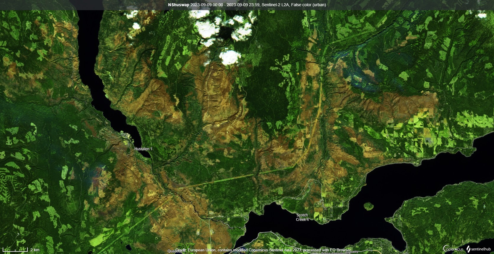
This aerial photo taken above Lee Creek clearly shows what happened after the aerial ignition lit a massive fire on August 17th. you can clearly see how the bacburn went out above West Lee Creek, leaving a strip of green forest between the powerline and the original fire. You can also see how the backburn crept under the powerline in Lee Creek Canyon, emerging above the community of upper Lee Creek Heights and then swept down destroying approximately 14 homes and structures.
BCWS posted a video on their Facebook site on the morning of August 18th. It was taken from a helicopter soon after the BCWS did a aerial ignition of an 11 to 14 km long controlled burn that was aerial ignited at 4 to 4:30pm just north of the powerline.
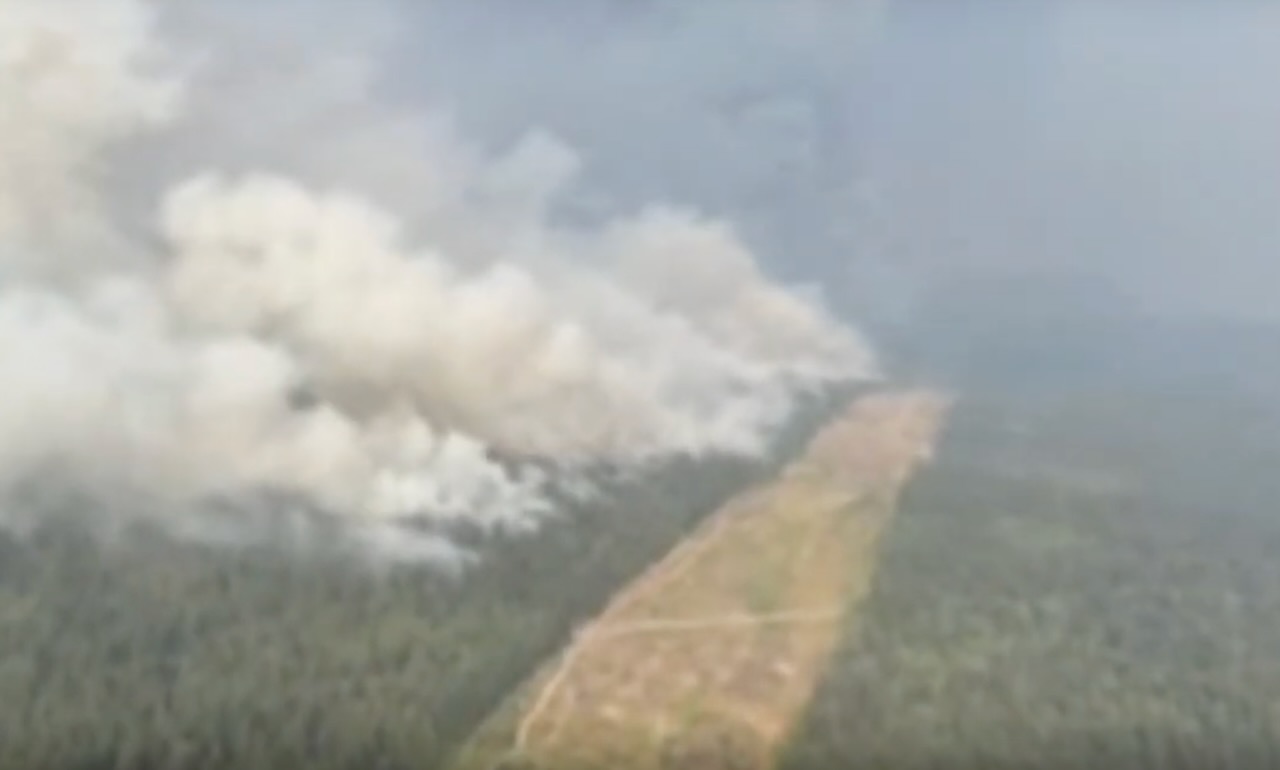
Their plan was to burn off the “fuel” (the existing forest) between the powerline and the southern front of the existing Bush Creek East fire to prevent the fire from advancing to the south. They were hoping to utilize the wind coming from the south with anticipation of the strong windstorm that was predicted to come from the north. Instead the windstorm came from northwest and blew the fire to the east where the next day it quickly devastated the North Shuswap communities of Lee Creek, Scotch Creek and Celista. Watch the video here
On August 17th, BCWS provided an media update that presented their plan for the controlled backburn. Here is the link to their YouTube video of their media briefing, watch and listen
On August 21st, there was a provincial media conference with Premier Eby that included BCWS spokesperson Cliff Chapman explaining how the backburn was a success that saved hundreds of homes, which is a complete fabrication to cover-up their extreme mistake that caused over 200 million dollars in damage. – Watch Here
Here is the August 25, 2023 CBC Network News compelling interview with me about the 41,852 ha wildfire that has ravaged the Shuswap Watch Here
Here are some CBC Kamloops Daybreak interviews from August 21 and 22: Interview with me – Listen and watch
Interview with the Columbia Shuswap Regional District Director for the North Shuswap (Area F), Jay Simpson: listen and watch
Interview with Lee Creek resident, forester and experienced firefighter, Jayson Warkinton – listen and watch
Skwlāx te Secwépemc chief recalls sheltering under bridge while fleeing wildfire – Listen
Key media articles (click to use the links to the stories):
What it’s like to flee a wildfire in B.C. (photo essay) The Narwhal
North Shuswap family shares story of wildfire home loss Salmon Arm Observer
Locals stayed to fight fires Globe and Mail
Opposition MLA pushes for reform CBC
Political flames over evacuation orders CBC
Police blocking food and supplies for locals Kamloops This Week
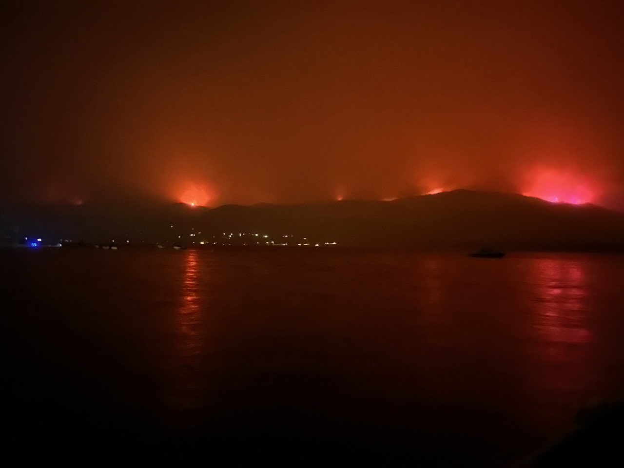
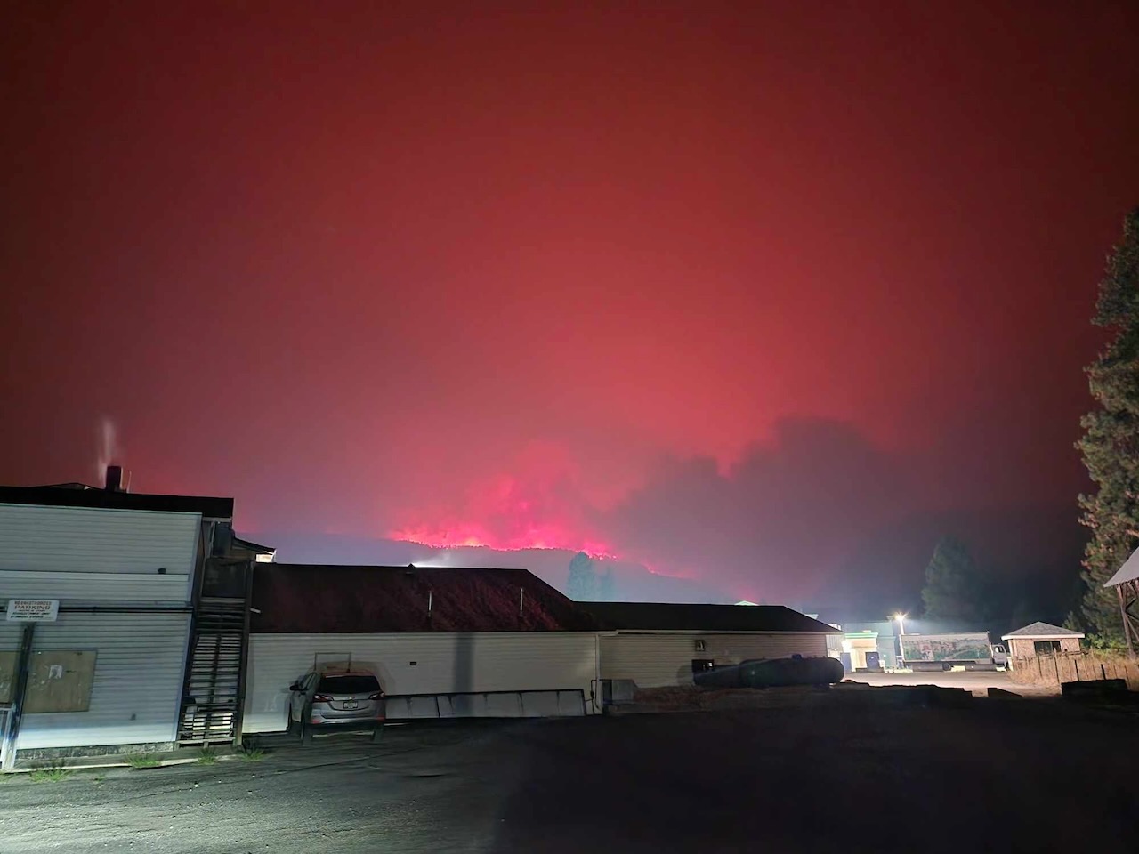
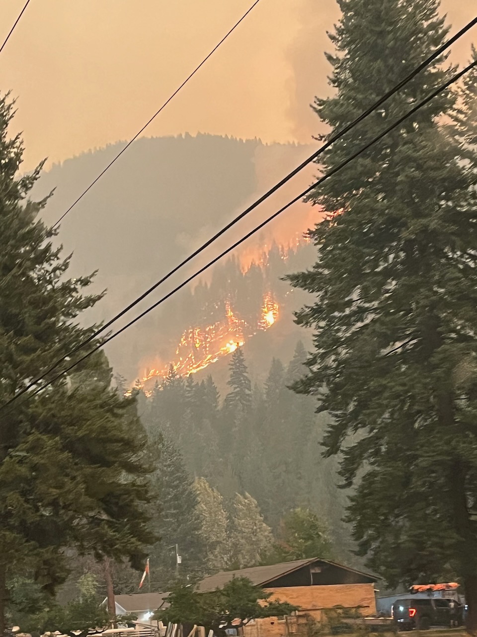
Images that show how the August 17th backburn grew to be an enormous firestorm that devastated the North Shuswap:
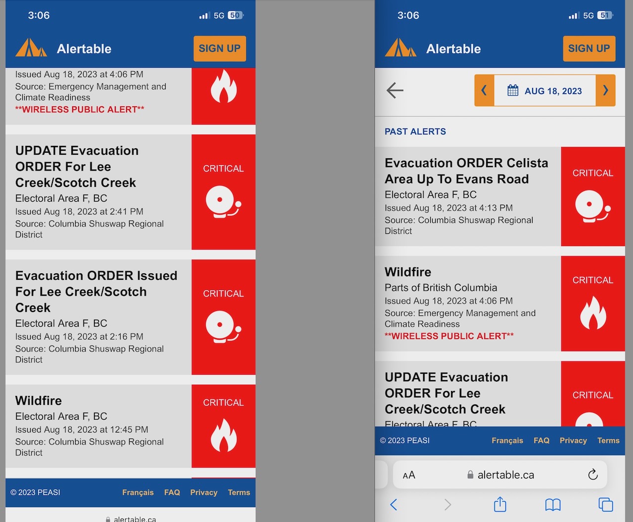
Another huge issue is the failure of the CSRD Emergency Operations Centre to issue evacuation orders early enough to allow residents to escape the fire. Thus, hundreds of people became trapped and many had to evacuate either by boat or over the logging road to Seymour Arm, and some drove all the way to Malakwa on the rough back roads. Here is are screenshots of the alerts showing the time these were issued:
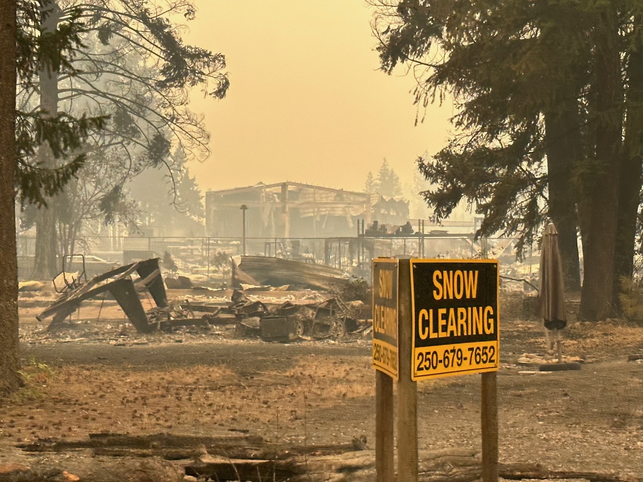
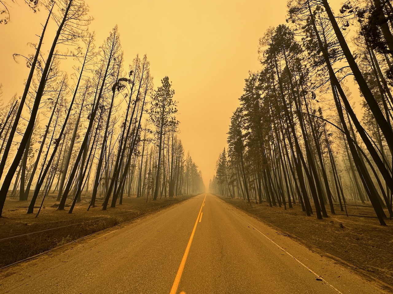
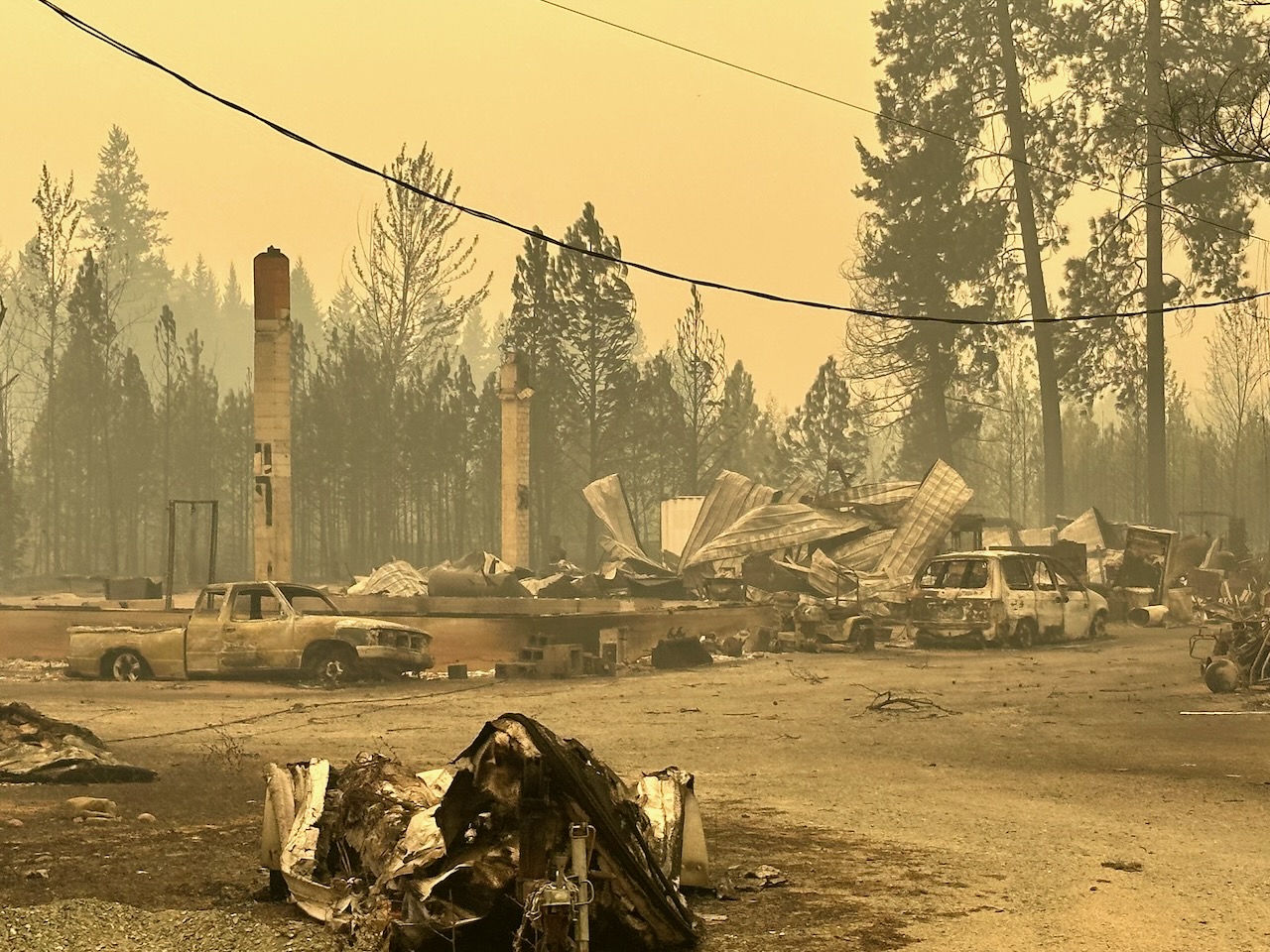
IMAGES OF THE DESTRUCTION IN THE COMMUNITY OF SCOTCH CREEK:
A recent video by Erica Witteman of the devastation seen along the Squilax Anglemont Highway that includes images of the homes before the fire. Watch Here
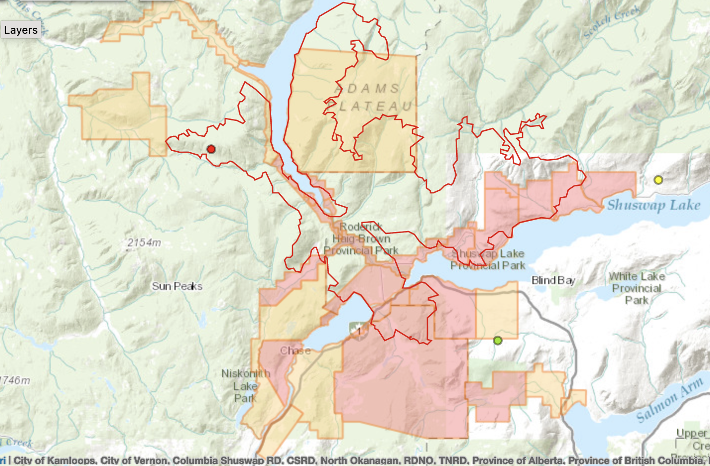
A BC Wildfire Service map of the fire showing the evacuation order and alert zones as of August 20, 2023:
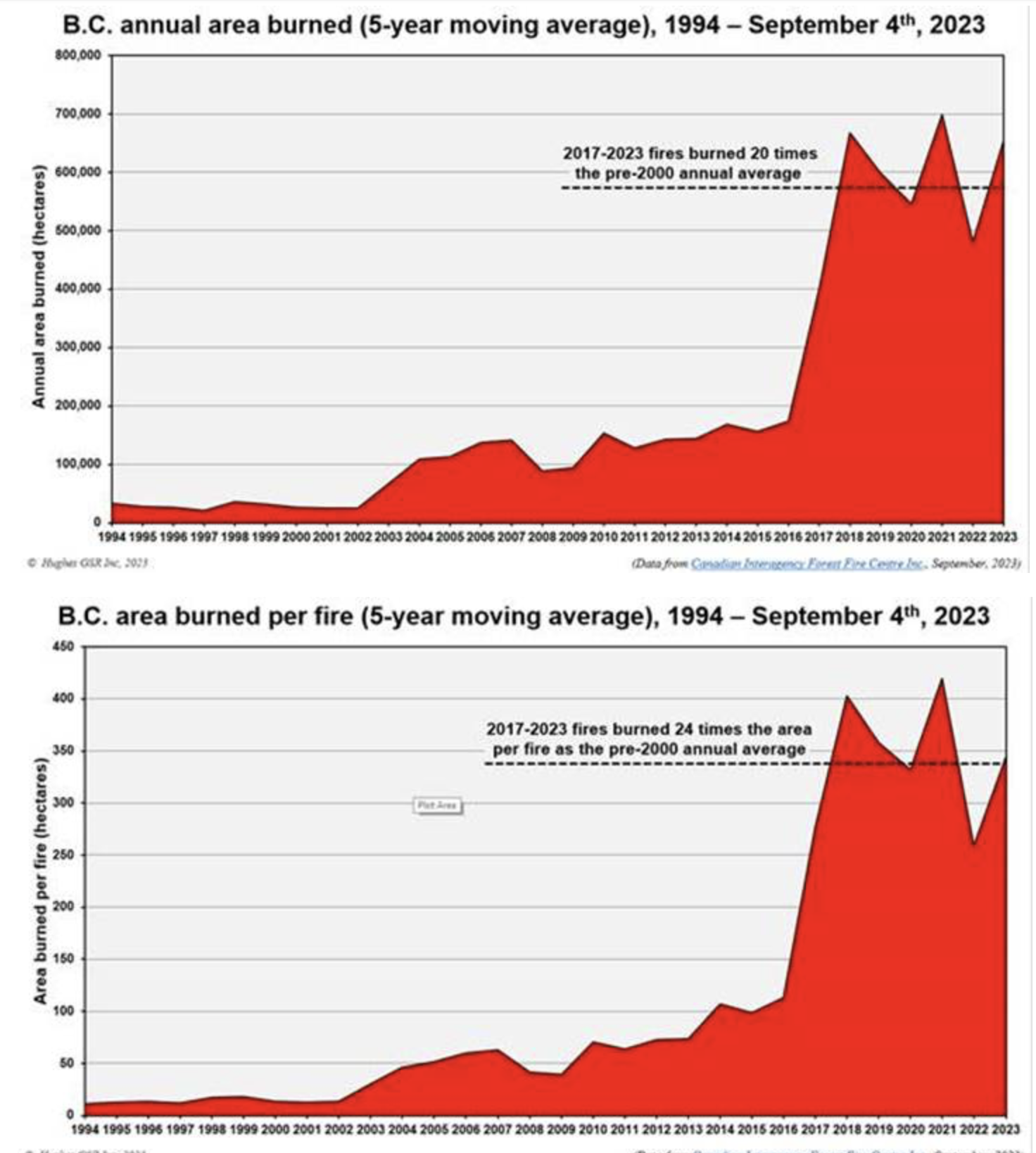
One of the most disturbing issues regarding the Shuswap Firestorm is that it is one more example of the escalating impacts of “climate boiling,” the new term for climate change coined by United Nations secretary general Antonio Guterres as it was confirmed that July 2023 had become the hottest month in the past 120,000 years. As a result of increased level of both carbon dioxide and methane gases in the atmosphere from the burning of fossil fuels and the sixty year plus practice of putting out forest fires thus increasing the fuel load of dead and dry trees and brush, in BC the annual area burned by wildfires has increased 20 times compared to the pre-2000 average and the area burned per fire has increased 24 times, as shown in the two charts below.
Learn more about how forests are being impacted by “climate boiling,” in this National Observer article, “Our Forests have reached a tipping point”