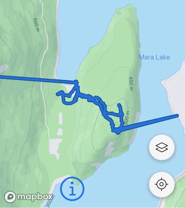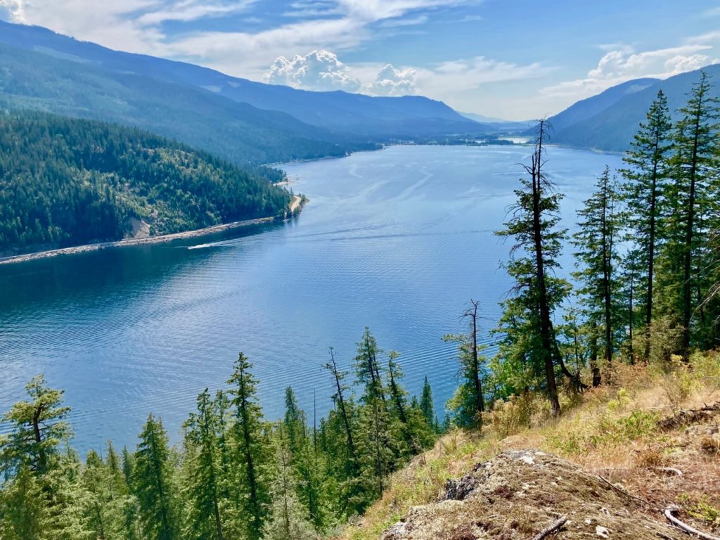
Mara Lake has a number of fascinating features including the Black Point Peninsula that juts out in the middle about halfway between the north and south ends forming a channel across from Swansea Point. I have long been keen to explore the area and recently canoed there with two friends to hike up to the peak.
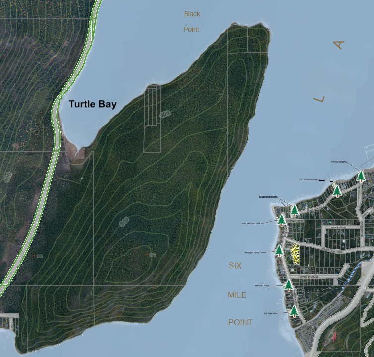
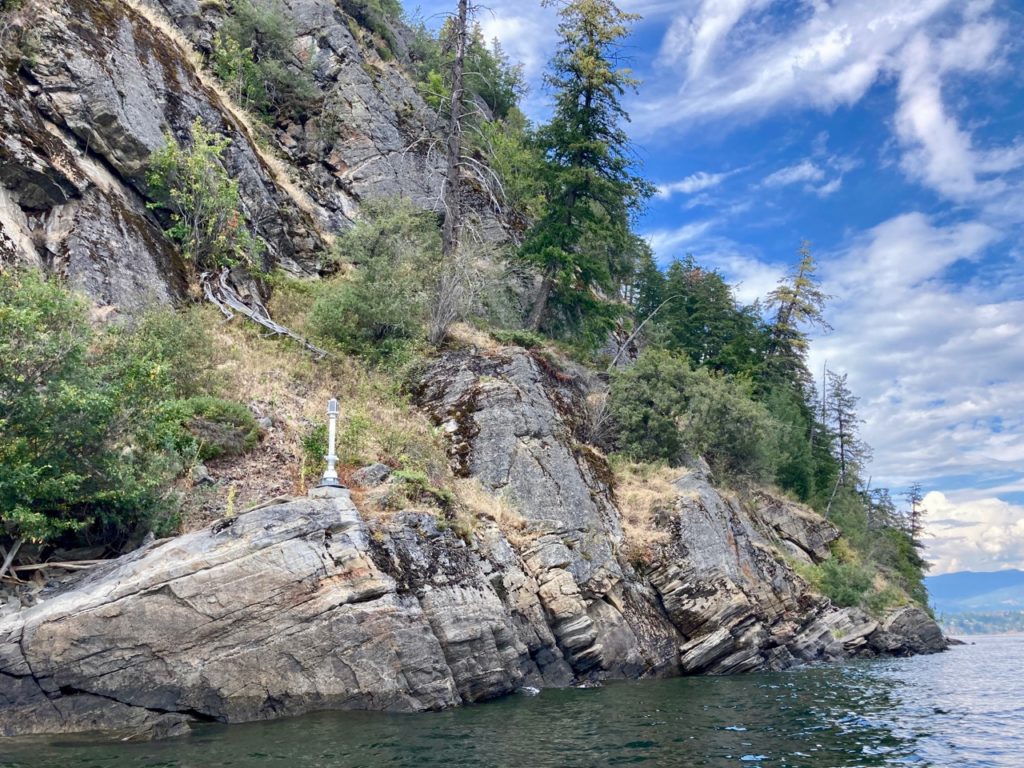
The only way to access the crown land on the peninsula is by using a non-motorized vessel to land at Turtle Bay after the lake has gone down, unless one is willing to tie up to a rocky shoreline and scramble up steep, rocky ground. Motorized boats must avoid the shallow water in the bay or there is a risk of getting the prop tangled with seaweed. Wherever the shoreline is approachable is private land with docks and cabins and thus is out of bounds for the public.
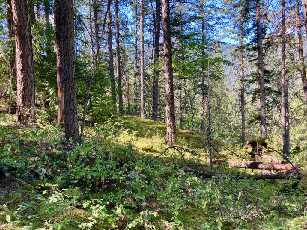
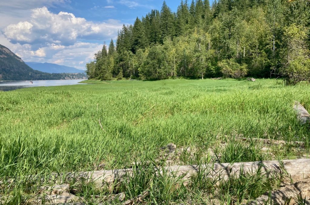
After landing on the edge of the now dried-up marshland, we headed inland and hiked up the hillside for about thirty minutes through rather uninteresting second growth cedar and fir until we reached the top where thick moss covers the rocks. Here we found the only key feature, a rim trail with spectacular views of the lake, the surrounding hillsides and the valley looking south. The trail did not go far to the south, but to the north it was well established and likely goes all the way to the Black Point where there are two cabins.
Upon our return to the lake, the peacefulness of the area was gone as we were bombarded by the sounds of boaters and children playing in the water. We spoke with local cabin owners who often have to cope with party boats that tie up in the bay and play loud music late into the night or disturb the shoreline with large waves from wake boarding and wake surfing.
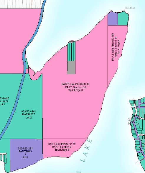
It is possible that the BC government has plans for the 452 acres of crown land on the peninsula, as it is divided into six parcels that range in size from one half acre to 357 acres. The parcel on the southeast side is designated a UREP or “use reserved for the enjoyment of the public.” The marshland in Turtle Bay is an environmentally sensitive area, is home to painted turtles and is used by many species of birds, including blue herons, grebes, loons, ducks and geese. Unfortunately, as the boat traffic and noise has increased over the years, the number of painted turtles, which has been designated a species at risk, has declined.
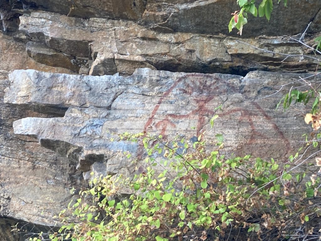
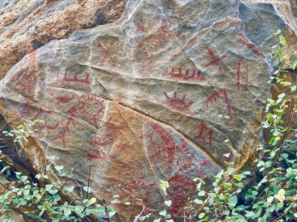
After hiking, we paddled south under the tall rock bluffs to view the ancient pictographs near the lighthouse. These are some of the best rock paintings in this region and many of the designs are unique. After examining the paintings, one gets the impression that some of the images could be aliens with helmets on, because of the odd shapes of the figures. According to one Splatsin knowledge keeper, oral history, and the transfer of intergenerational cultural information such as pictographs was disrupted by colonization, the residential schools, sixties scoop and TB hospitals (holding children hostage although they were not infected) by separating children from their parents and elders depriving them of learning the stories about their past.
There was not enough time to paddle around the entire peninsula to Hurricane Bay, named after the windstorms that often pound the south side blowing down trees. If we had, we could have explored the old mine shaft and looked for the bubbling soda spring that was called Pilpilpoopil by the Secwepemc. The exploration revealed that this peninsula is not suitable for public access and lacks the kind of interesting features found in most parks. There is not an old growth forest to marvel at, there are no interesting geological formations and while the view from the top is outstanding, there are many other great views to be had elsewhere. The crown land portion of the Black Point Peninsula will hopefully remain undeveloped for many years to come.
POSTSCRIPT
Perhaps the best outcome for any land use decision regarding the peninsula would be for it to become a Splatsin protected area. The Shuswap Okanagan rail trail is close, but there is no possibility of a trail connection because of the private land. The erosion problem caused by the wake boats will likely never be solved, as it would be too difficult to manage boating on the lake. I was amazed to see how slow the boat was going with a young girl “surfing” on a wakeboard behind it. It certainly is an expensive sport that is only available for those who can afford expensive, high performance boats and the fuel to run them.