PART ONE
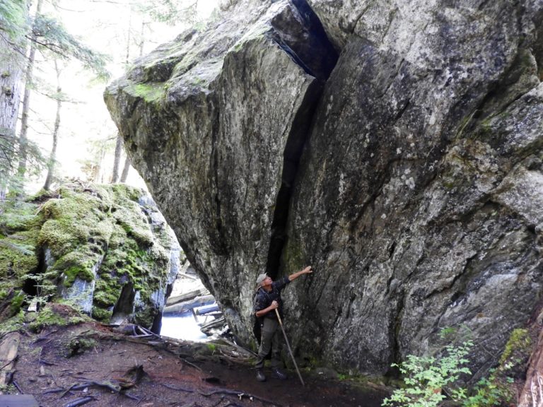
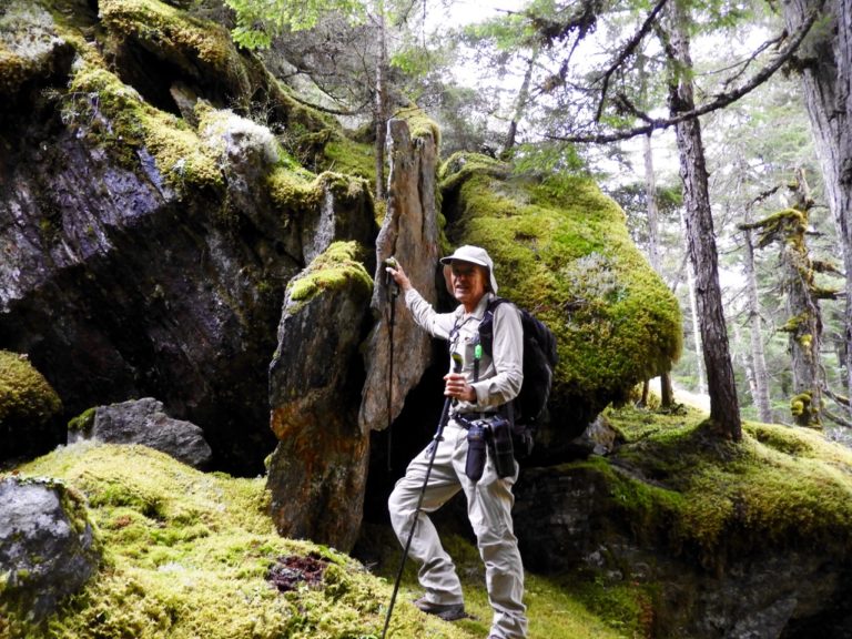
It had been twenty-five years since the last time I visited one of the truly magical areas in the Shuswap, the English Creek valley southeast of Three-Valley Gap. Two intrepid local adventurers, Blaine Carson and John Vivian joined me recently for the tour into a landscape fitting for the imaginary world of the Hobbits, on a 1.3-kilometre long trail along English Creek that winds around massive boulders covered in thick moss underneath giant old growth cedar and hemlock trees. Amidst the wonder, we found small signs that designated climbing routes, as this valley had also become a destination for the sport of bouldering.
The conservation history for the English Creek valley began in the early 1990s, when the BC government dedicated staff time and funding to double the area of the province protected as provincial parks. Their newly established “Protected Areas Strategy” identified two goals, large areas of over 1000 hectares that contained unique and threatened features and the smaller Goal II areas that held regionally unique values. In February 1995, I received a short-term contract to find potential Goal II areas that deserved protection in what was then the Salmon Arm Forest District.
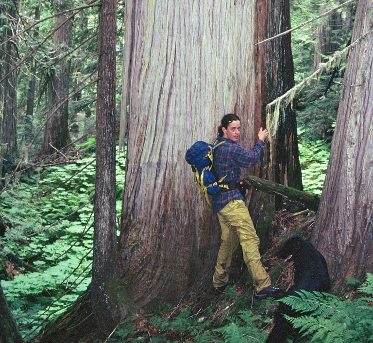
Despite the negative reaction from the local forest industry about my contract, I began the project by initially spending hours at the forest district office studying forest cover maps looking for remnants of old growth forests that still could be found primarily in the headwaters of local creeks and rivers. One afternoon, a forest service technician and a local company forester told me about a giant, 14-foot diameter cedar tree in a stand of old growth forest below Mt. English.
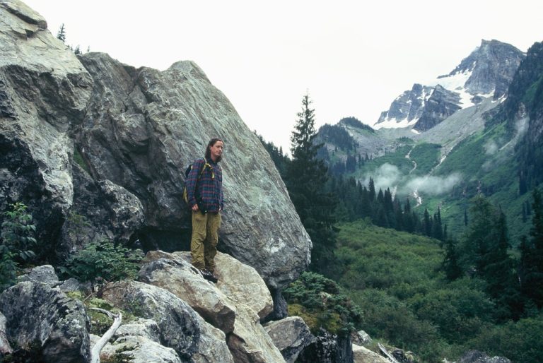
Although it was in a block that had been approved for years, the trees were growing in loose shale, and the forest company had been reluctant to log it because reforestation would be extremely difficult. Since a site visit was the next step, I enlisted the help of a young local biologist, Jeremy Ayotte, who joined me for the first exploration. As we drove higher and higher up a road we encountered a talus slope and giant boulders where the road fizzled out so we set out on foot in an area that appeared to be prime grizzly bear habitat.
To the west was the towering peak of Mt. English and to the east was indeed a rare, high elevation old growth cedar forest on a steep slope heading up to the sub-alpine English and Scottish Lakes. We searched for the reputed giant cedar tree, but were unsuccessful. Nonetheless, this forest ecosystem deserved protection and when land use planning began the following year, the English Lake Goal II candidate was included in the process. It was officially approved along with over 25,000 hectares of new Shuswap area parks five years later after intense negotiations.
The next column will explain what has happened in this valley recently….
POSTSCRIPT
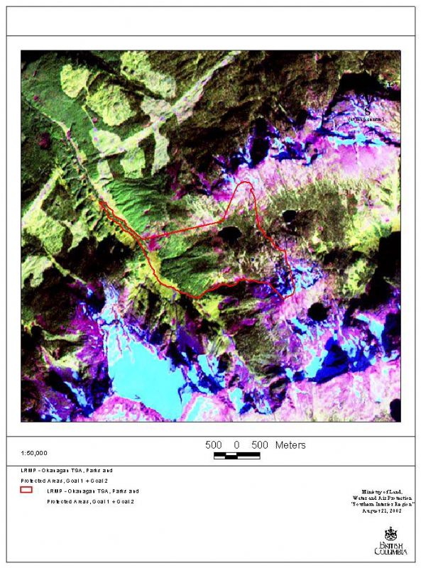
I still have the file from 1995 that rates each of the proposed Goal II areas. the English Lake (originally called Englishman River – because of an error on an early map that labelled the creek as a Englishman River!) was given a Very High rating. The threat to it was considered high, as were the values present. There was an existing UREP (use reserved for the enjoyment of the public) reserve around English Lake.
Other areas considered included the upper Perry River, Myoff Creek, the upper Ratchford Creek and the upper Wap Creek (which was protected). The upper Perry was protected too, but as yet has not been declared a park.
In 1995, we drove on a logging road to reach the old growth forest. This road is no longer passable, even by hiking as it is overgrown. Although its inaccessibility is good for wildlife, it means that the public can not get there to explore a significant old growth forest. We had hoped that one day a trail could be built that heads up to English Lake, however the hillside is too steep. The lake can be accessed by driving east further up the hill on the logging road to the north, where it become sub-alpine and is quite rocky. It is below Mount MacPherson.
The “tail” on the agreed upon protected area was created to protected the strip of old growth alongside the creek, that is not part of an old growth management area. In the next column, I will explain what has happened to this area.